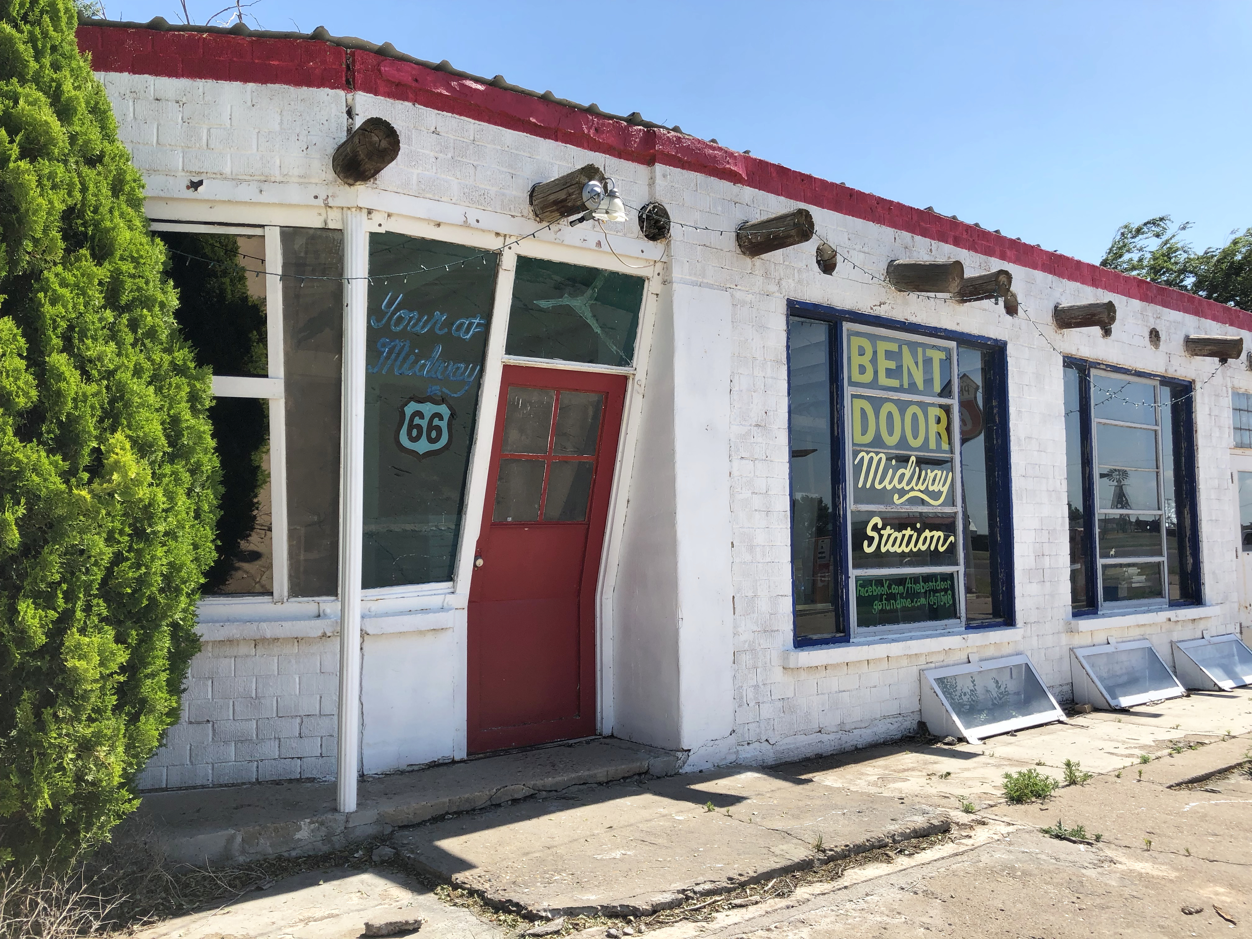
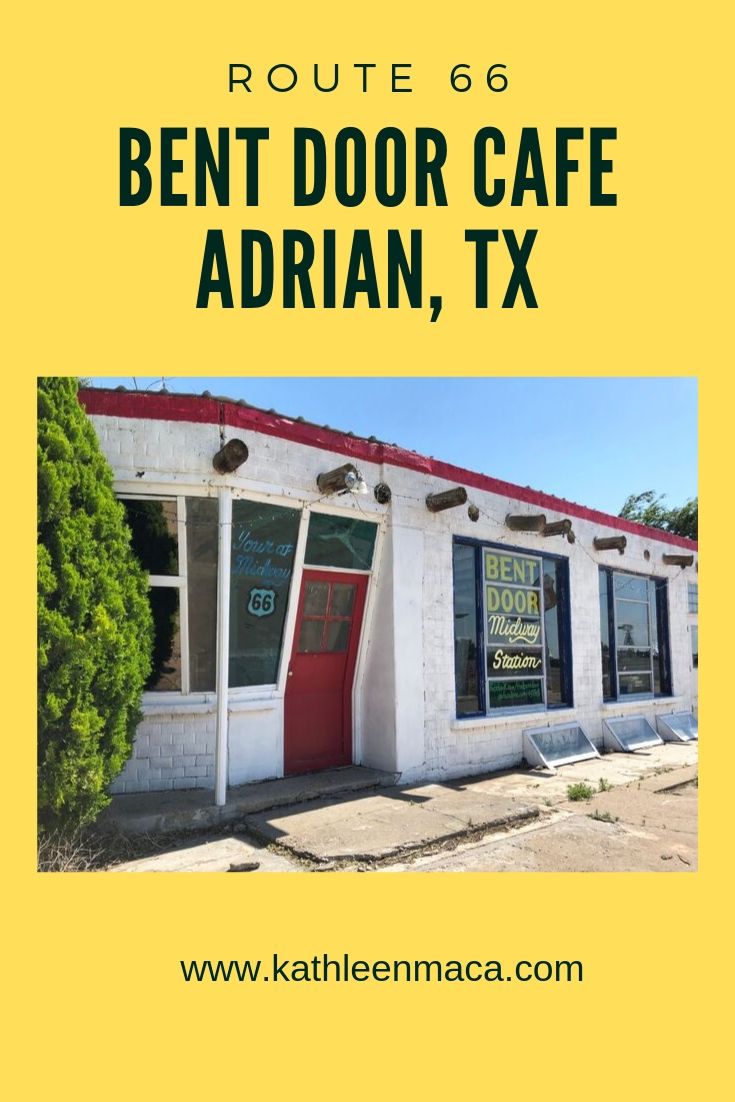
Can you see it? Yep, the door is actually bent but not because it is damaged.
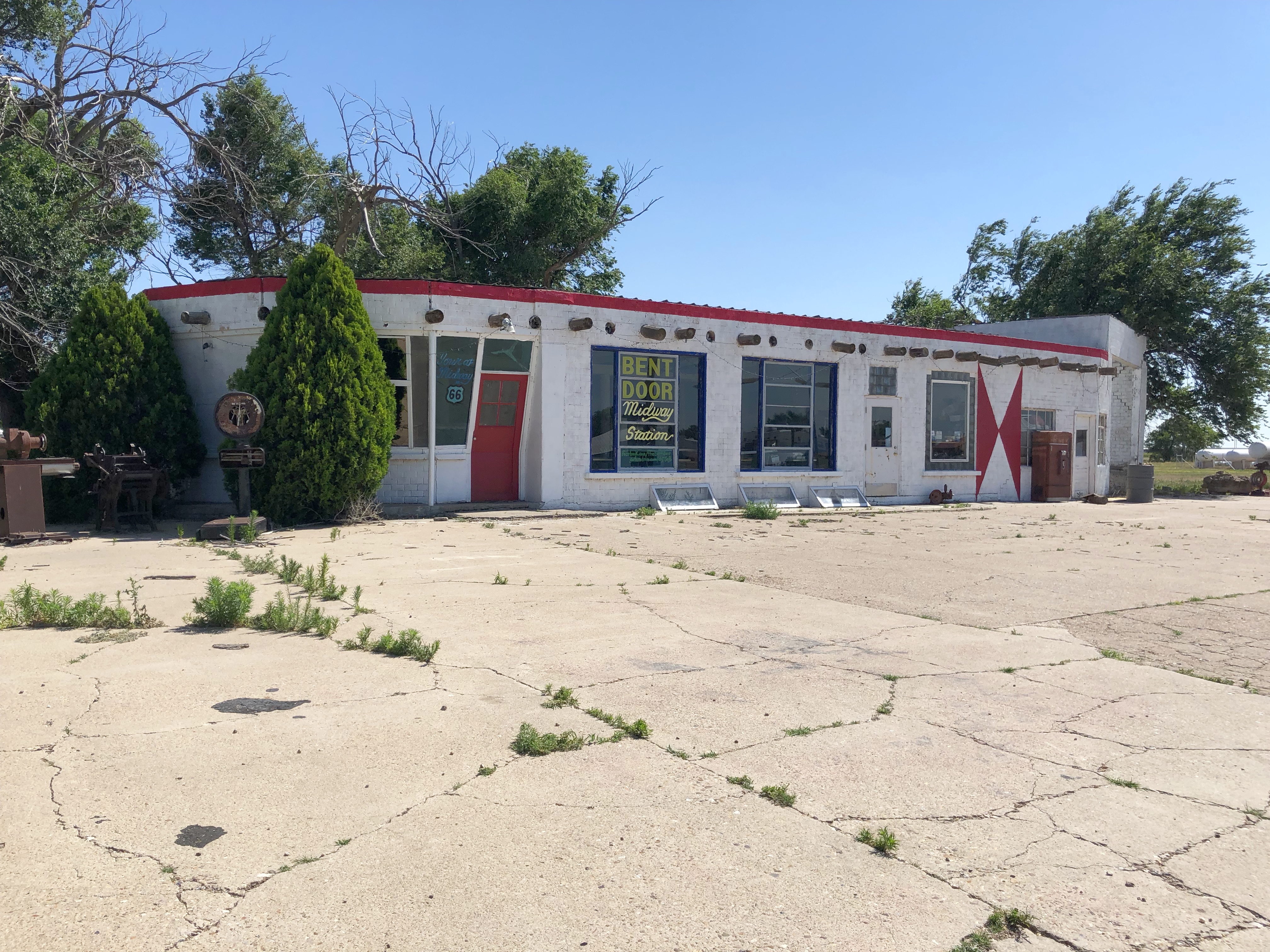
There’s nothing cooking in the kitchen of Route 66’s Bent Door Café in Adrian, but it’s still one of the most recognizable stops along the Mother Road. A highly frequented photo stop along the Texas Stretch of the route, it had a bustling business during its heyday when it was a 24-hour café and gas station.
Parts of the building have been on this site since the 1920s, but it was during the 40s that it gained its unique appearance.
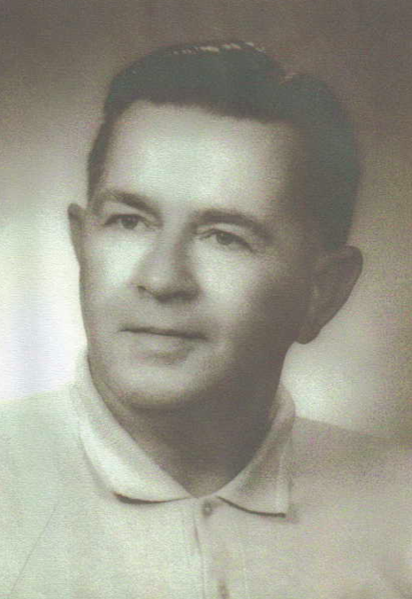
When Robert Harris returned from serving in the military in World War II, he put his efforts into wheat farming. After a particularly successful year in 1947, he used his profits to buy the original small structure and began looking for a way to turn it into one of Route 66’s unique attractions.
The answer came from an unlikely place. Nearby Dalhart Air Force Base began selling surplus military in 1948 after being decommissioned. The imaginative Harris purchased the top portion of the air control tower that included angled windows for viewing the airfield. He incorporated the tower into the northeast section of the building, replacing one of the angled windows with a door been to fit the slanted walls of the structure. How’s that for an unusual vision?
Harris celebrated the completion of this dream with a huge dance with a live band and BBQ for the community. Oddly, the very next day he closed the business and went to Germany for two months. There is speculation that he just wanted to see if the project could be done.
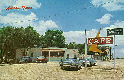
His mother took charge of the business, selling it to Manuel Loveless who turned it into Tommy’s Café in the early 60s.
The attention-grabbing look was a success in luring travelers off the road for food, gas and souvenirs. A former waitress shared memories of the café being filled with stranded people during winter blizzards.
But being unique couldn’t save business from declining when I-40 was built bypassing the small town.
That era of the café closed in 1972, and the café and station were sold to a family that let the architectural oddity fall into disrepair, eventually losing for non-payment of taxes.
When Harris got wind of the building being slated for demolition in 1995, he bought it back. The county gave him the ultimatum of having it back in operating order in just two months or the demolition would be carried out.
Despite the heavy damage to the building, Harris wasn’t about to see it torn down. He worked around the clock for two straight months to restore his one-time dream. He set a reopening date for September 9, 1995, but he café never re-opened.
Oddly the Bent Door Café was never the official name of the business.
In July 2006 Roy and Ramona Kiewert purchased the property and began the process of gradual restoration that’s still ongoing. You can follow the progress on their Facebook page. https://www.facebook.com/Thebentdoor/
.
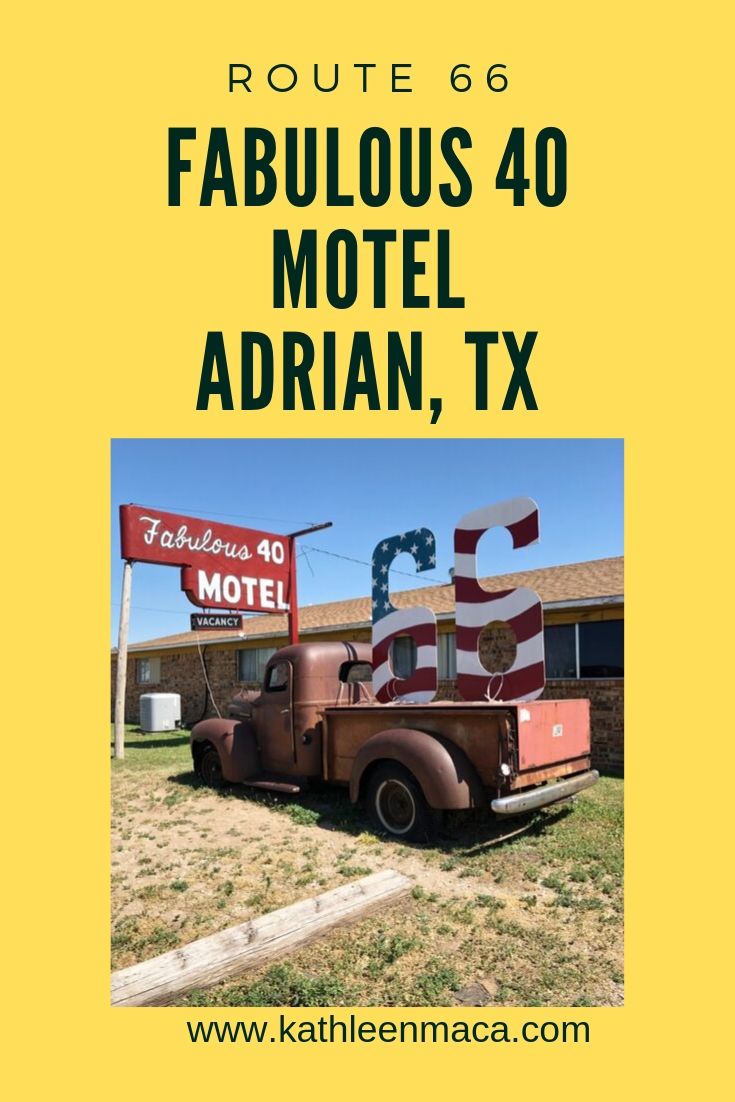
The Kiewerts also own the Fabulous 40 Motel next to the Bent Door. Don’t you just love the name? If the motel doesn’t catch your eye, the old rusted pickup with a huge wooden “66” in the bed sure will.
The motel was built by Kenny and Marjorie Callstrom in 1967. Ramona Kiewert explained the origin of the name to me this way:
“When the building was being built, the original plans were for two buildings with 20 rooms each (40 total), and at the same time Interstate 40 was going in so…Fabulous 40s Motel on I-40.”
The 20-unit motel closed in 2004 after the couple passed away, but luckily relatives kept the property in fairly good shape. After being shuttered for more than a decade, the Kiewerts came to the rescue. They are restoring the property room by room, but several of the guest rooms are open and receiving great reviews.
A quick check on traveler review websites show just how much visitors enjoy the friendly family that hosts them, and the free continental breakfast served in the recreation room.
As I walked beneath the carport at the Fabulous 40 to take photos further onto the property I was greeted by Ramona who was evidently alerted about me by a motion sensor. She was so sweet that I wished I was able to stay overnight, but I had to settle for a short chat and some photos.
The Fabulous 40 is alive and well, making guests feel like a part of the Route 66 family.
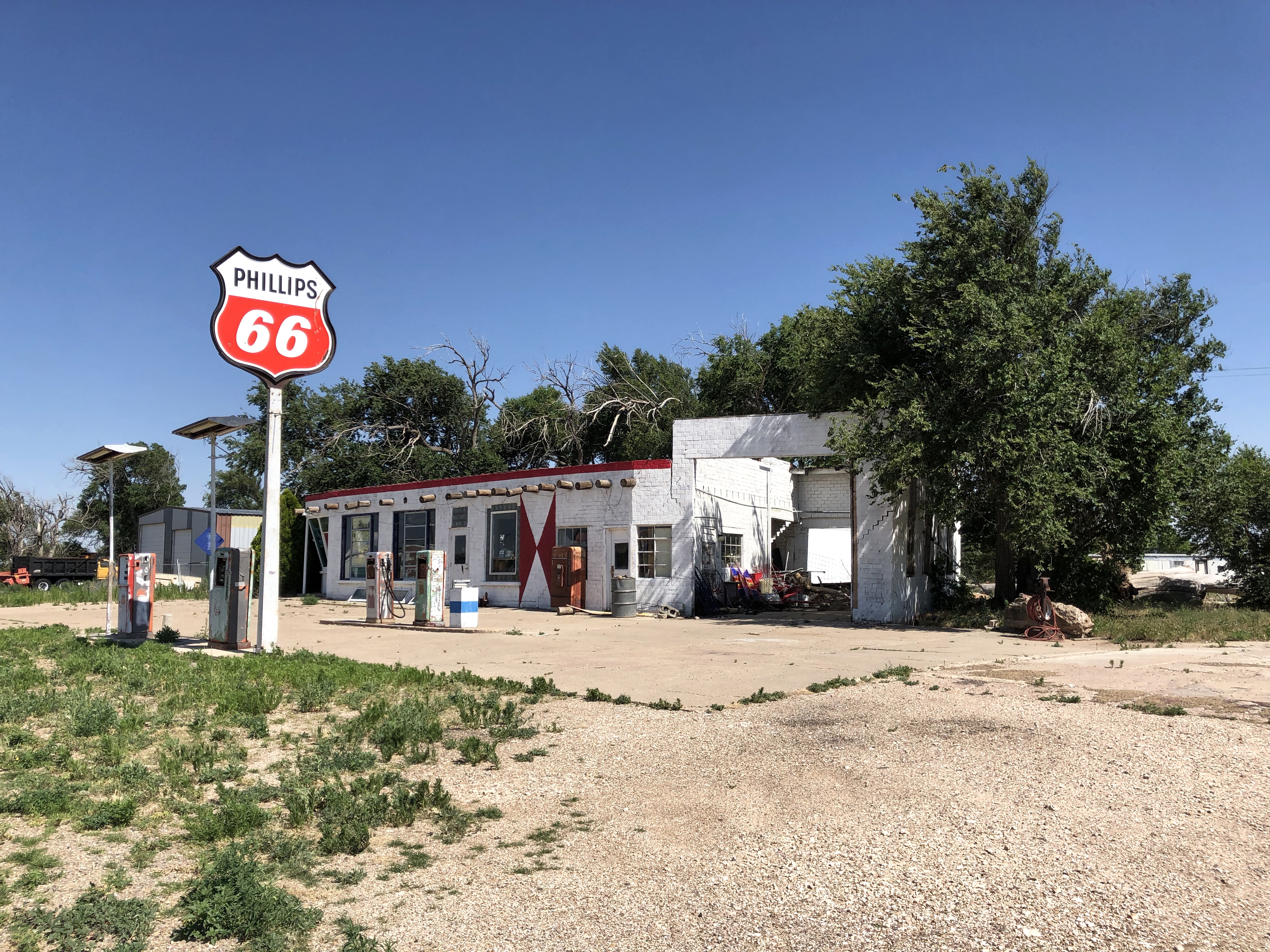
As if they didn’t already have their hands full, the Kiewerts have also rescued a 1920s Phillips station, moving it all the way from Vega to Adrian three years ago! It doesn’t appear on Google maps as of the date of this blog post because the Google images haven’t been updated, but it’s there. Once known as Knox’s Phillips 66, it patiently waits on their property for its turn at restoration.
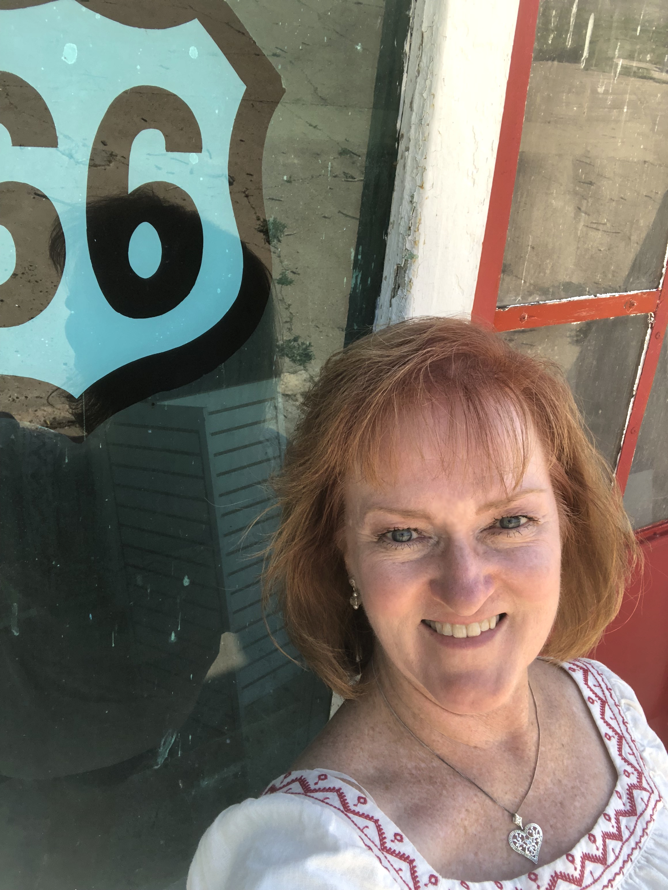
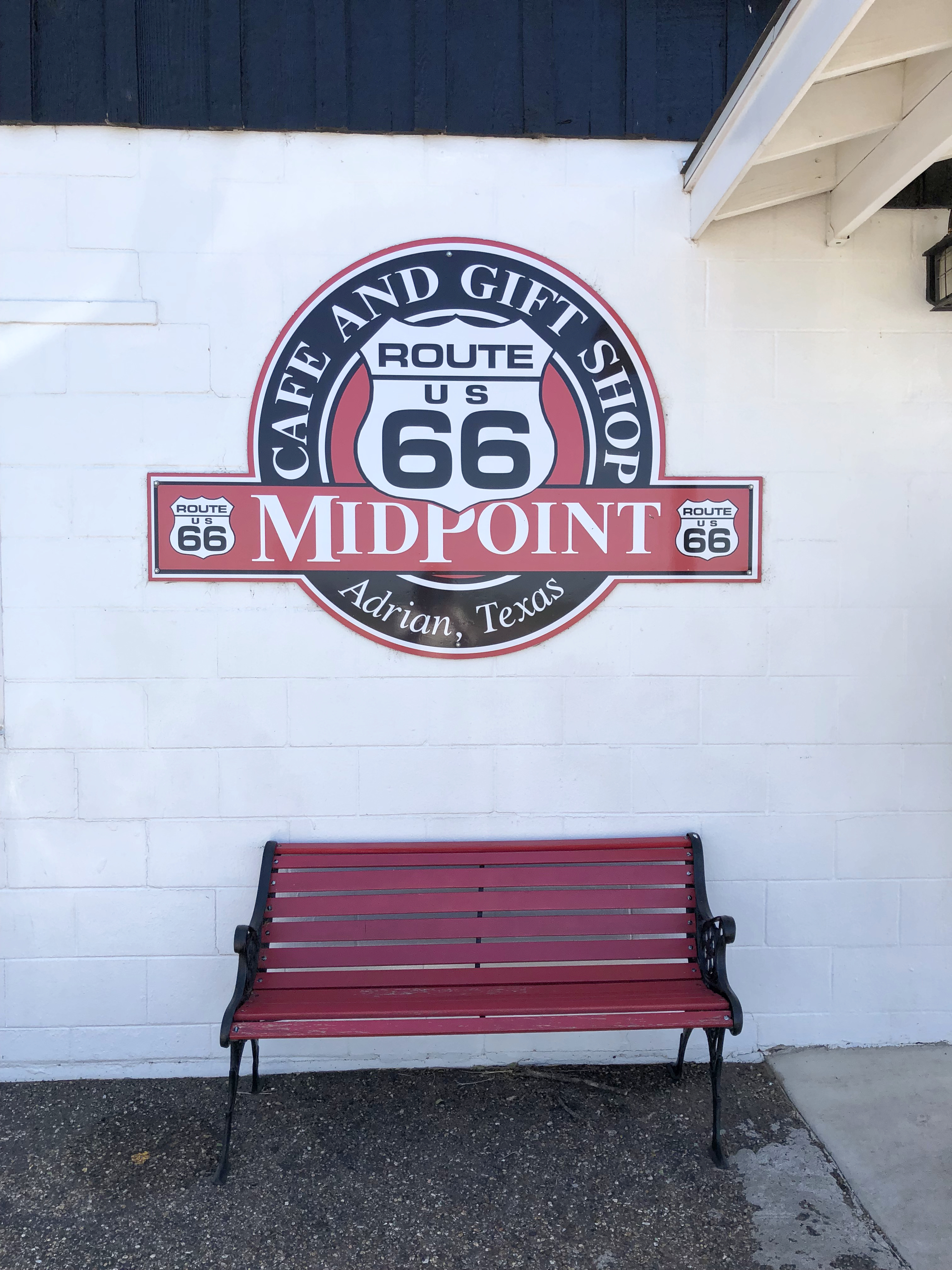
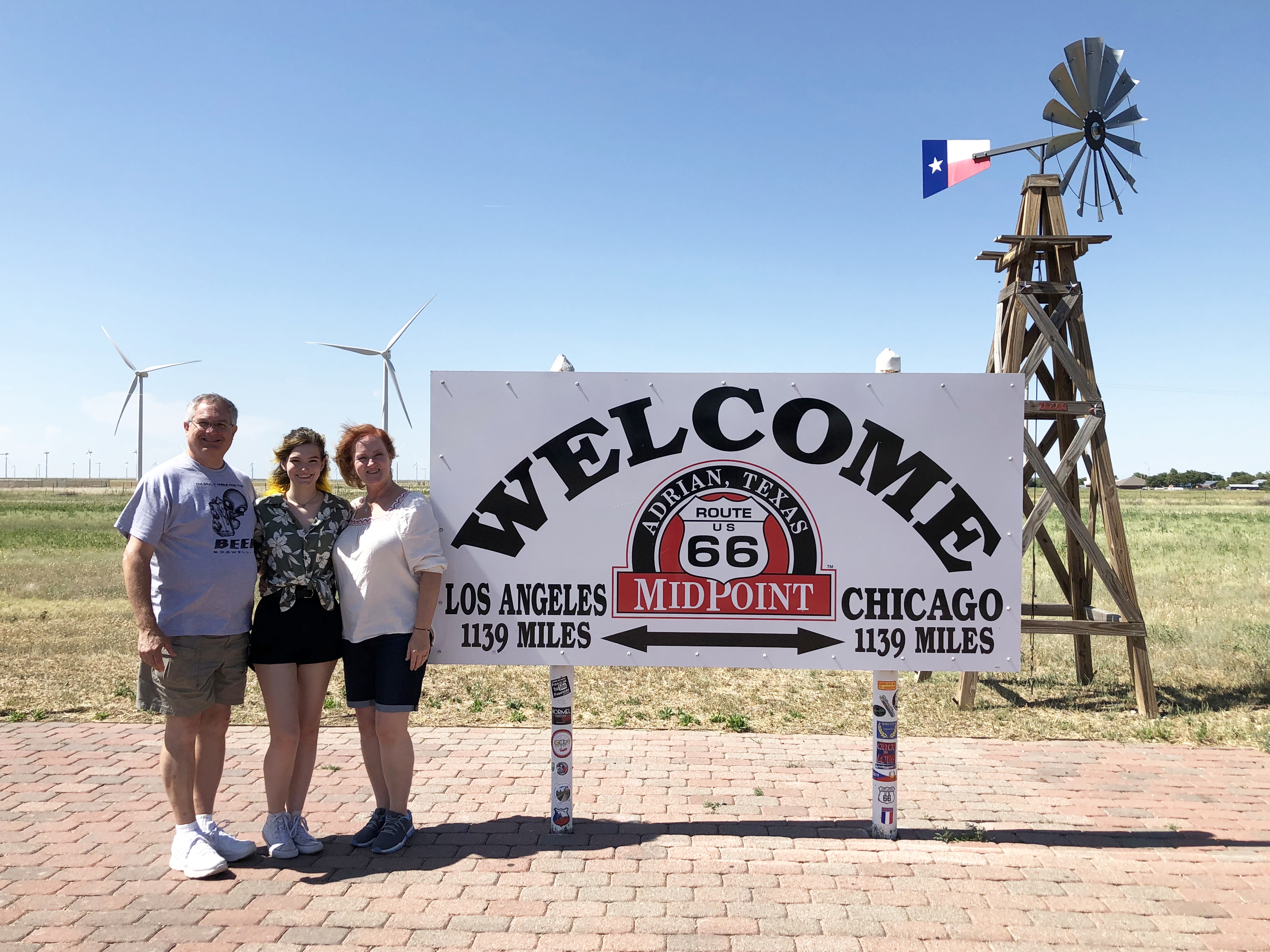
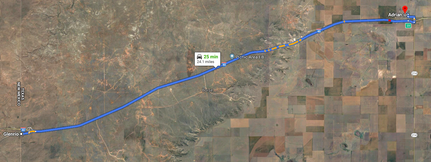
Leaving Glenrio we headed just 25 minutes east down Route 66 to the tiny town of Adrian, whose claim to fame is being the “geo-mathematical” midpoint of Route 66.
1139 miles to Los Angeles and 1139 miles to Chicago, or as they like to say, “When you’re here, you’re halfway there!”
Like so many other small towns that dot I-40 across Texas, Adrian began when it was chosen as a stop on the Rock Island Railroad. Never mind that the first train didn’t arrive at the station until 1909.
Even though it had its own printing press, post office, lumber yard, blacksmith, brickyard, bank, and running water pipe the scarcity of water and recurrent droughts kept the farming community small and by 1915 the entire town was made up of only 50 people.
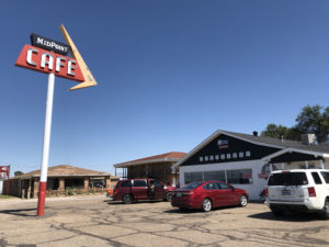
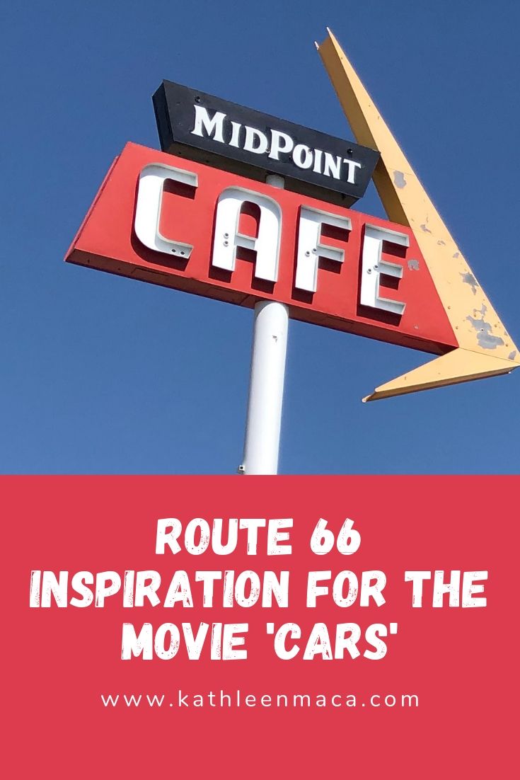
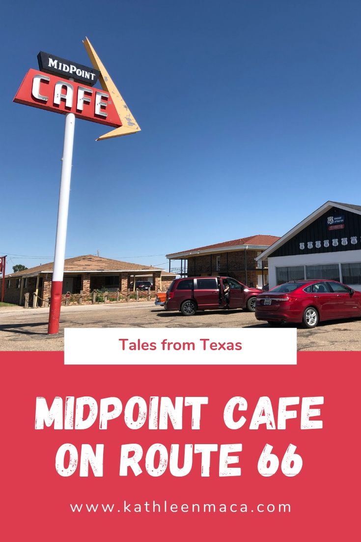
After we took a left at the first intersection after Exit 22 and went over the overpass, and the iconic Midpoint Café appeared on our right (not that there are so many other buildings around you might get confused!).
Midpoint is the oldest continuously operated café between Amarillo and Tucumcari. It was once a one-room building with a compacted earth floor built in 1928. A waitress named Zella Crin brought her dream of owning her own BBQ restaurant to Adrian and leased the building, naming her café Zella’s. True to her roots, she had the wood for her fire pit brought in from Oklahoma.
In 1947 the café, which was then open 24/7, was enlarged to accommodate the growing number of visitors traveling Route 66. After Zella passed away, Jesse Fincher and Dub Edmunds bought the place in 1956 and operated it as Jesse’s Café along with the gas station next door for 20 years.
When business took a downward turn because of I-40 bypassing the town (is this story starting to sound familiar?), they sold it in 1969.
Terry and Peggy Creitz operated the restaurant as Peggy’s Café, and another owner changed it to Rachel’s before the café was sold to Fran Houser in 1990.
Houser redubbed it the Adrian Café and ran it until she retired in 2012, renaming it Midpoint Café to capitalize on it’s unique location along the Mother Road.
But its location on Route 66 isn’t its only claim to fame. Houser and her café were the inspiration for Flo and Flo’s V-8 Diner from the movie “Cars,” and the characters of Mia and Tia were based on two of her employees at the time, sisters named Christina and Mary Lou Mendez. You can even spot Fran and her café mentioned in the film’s credits.
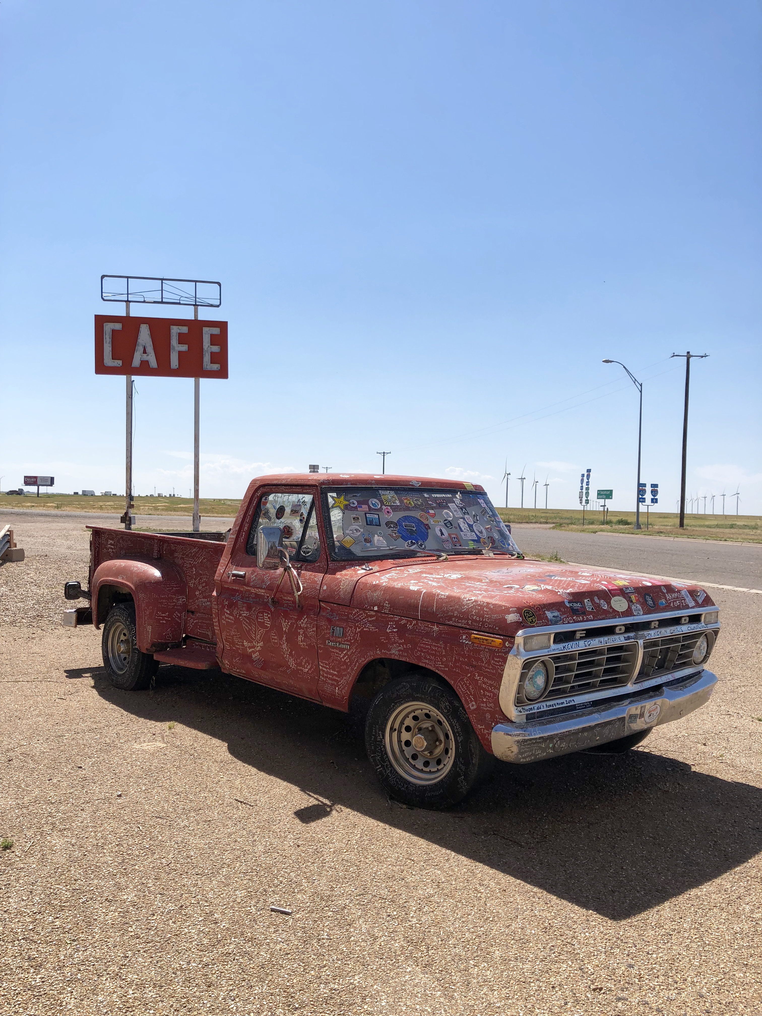
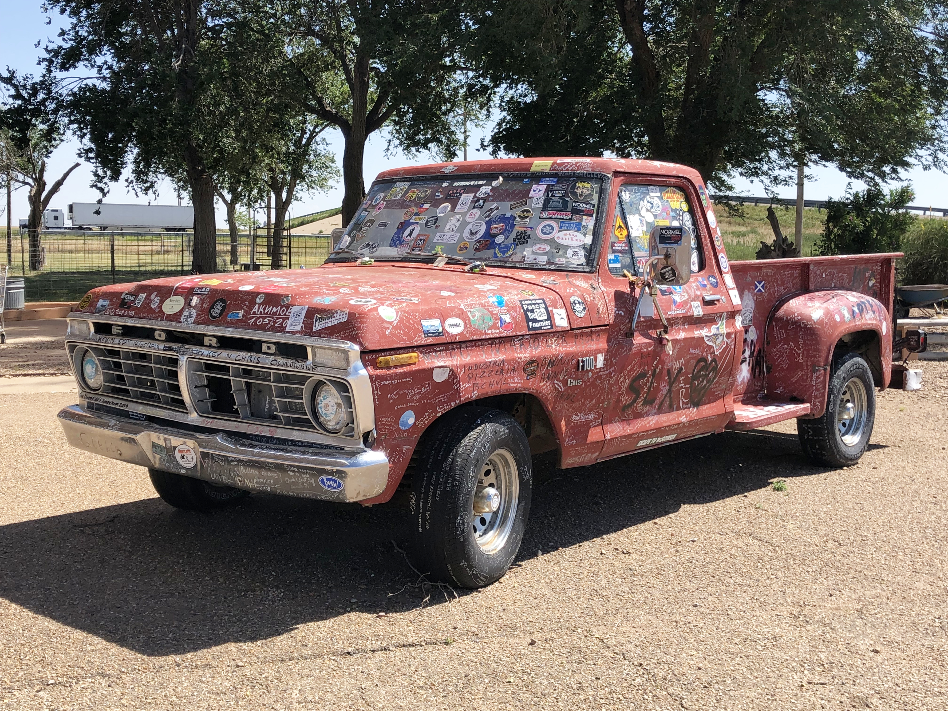
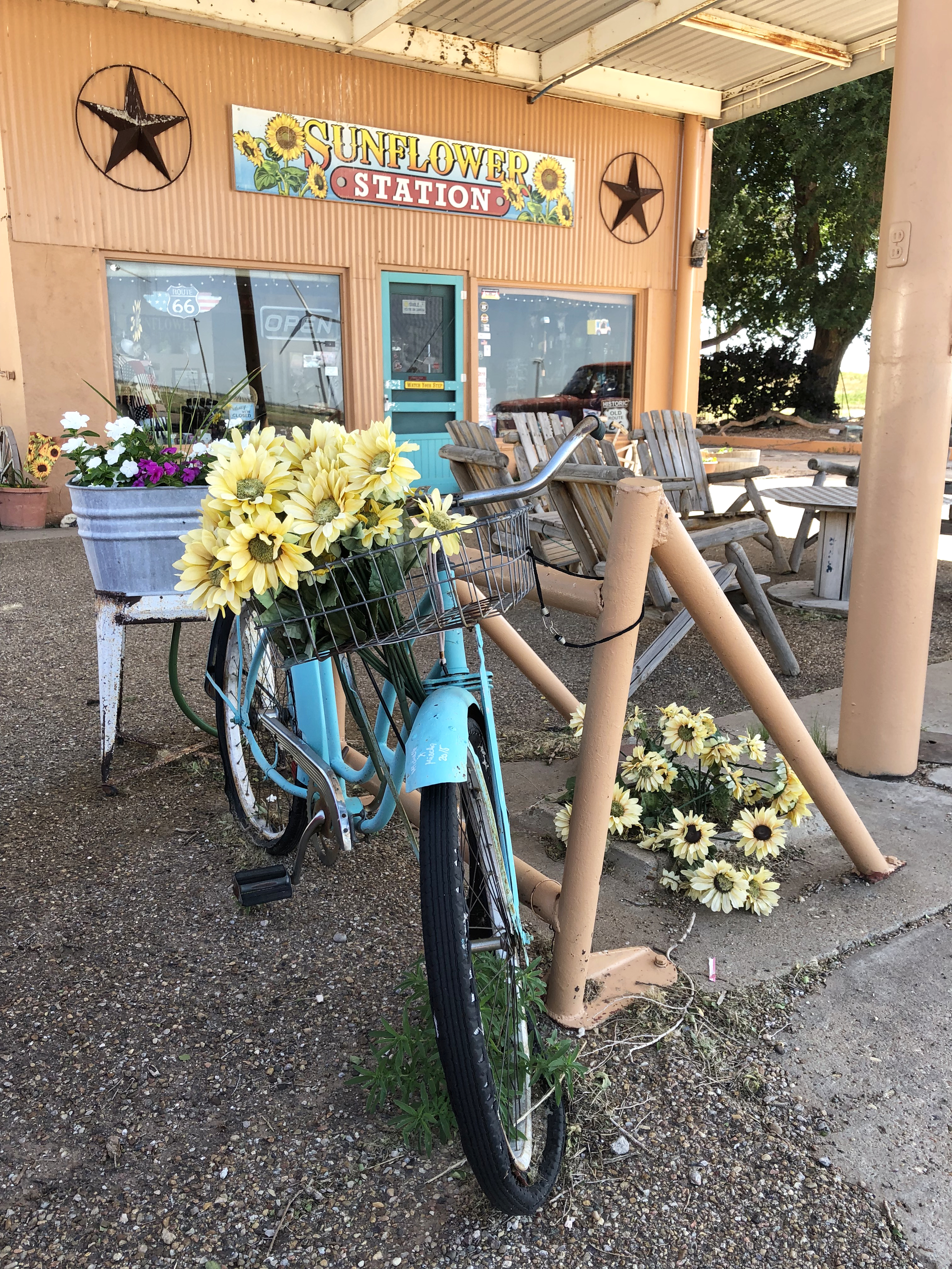
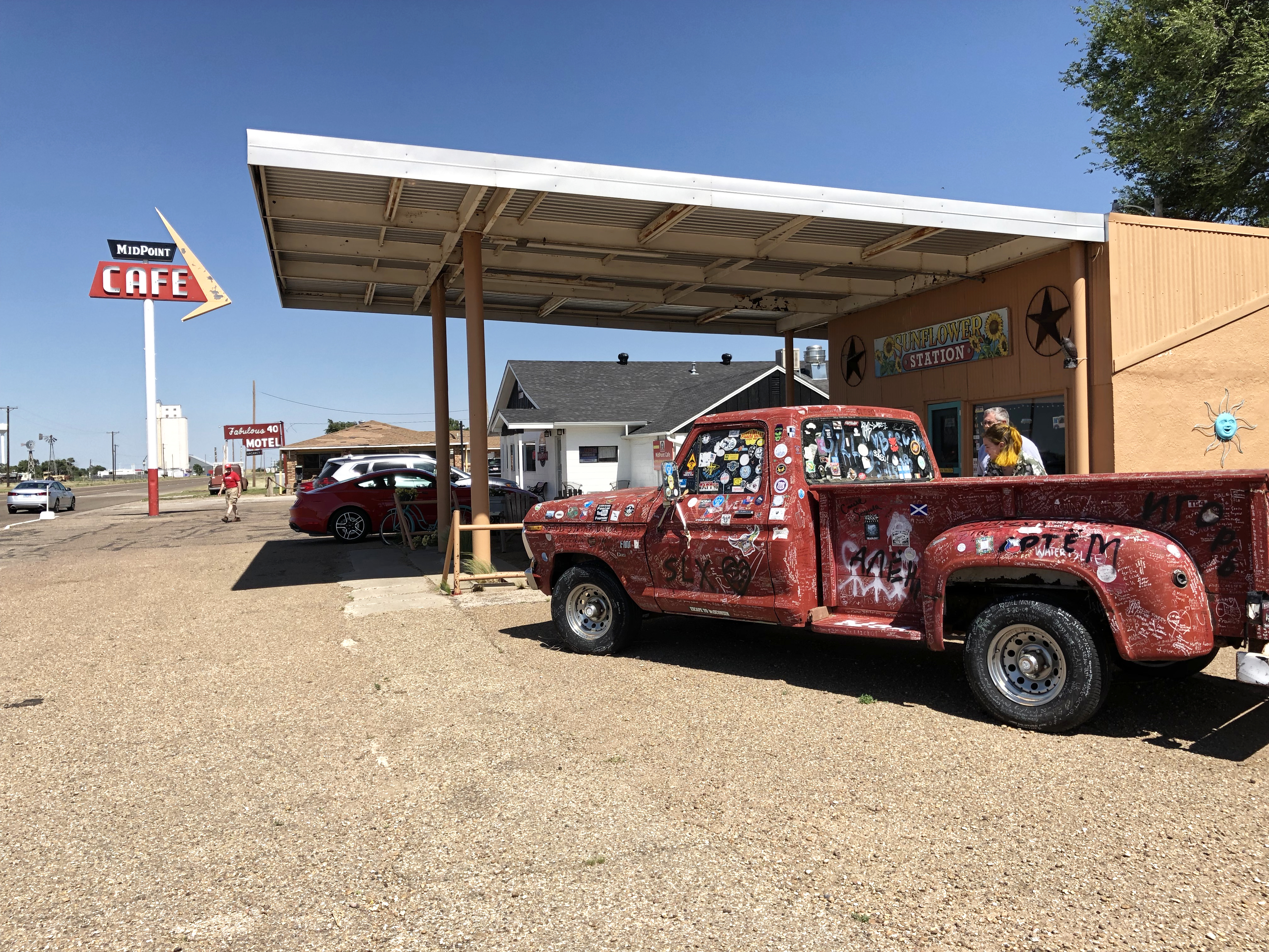
What was once a gas station next door is now an antique and souvenir shop named the Sunflower Station. In front is an old, red pickup that visitors have written their names all over. Most seen to have been done in a white sharpie, so if you’re planning to stop in you might want to bring one along.
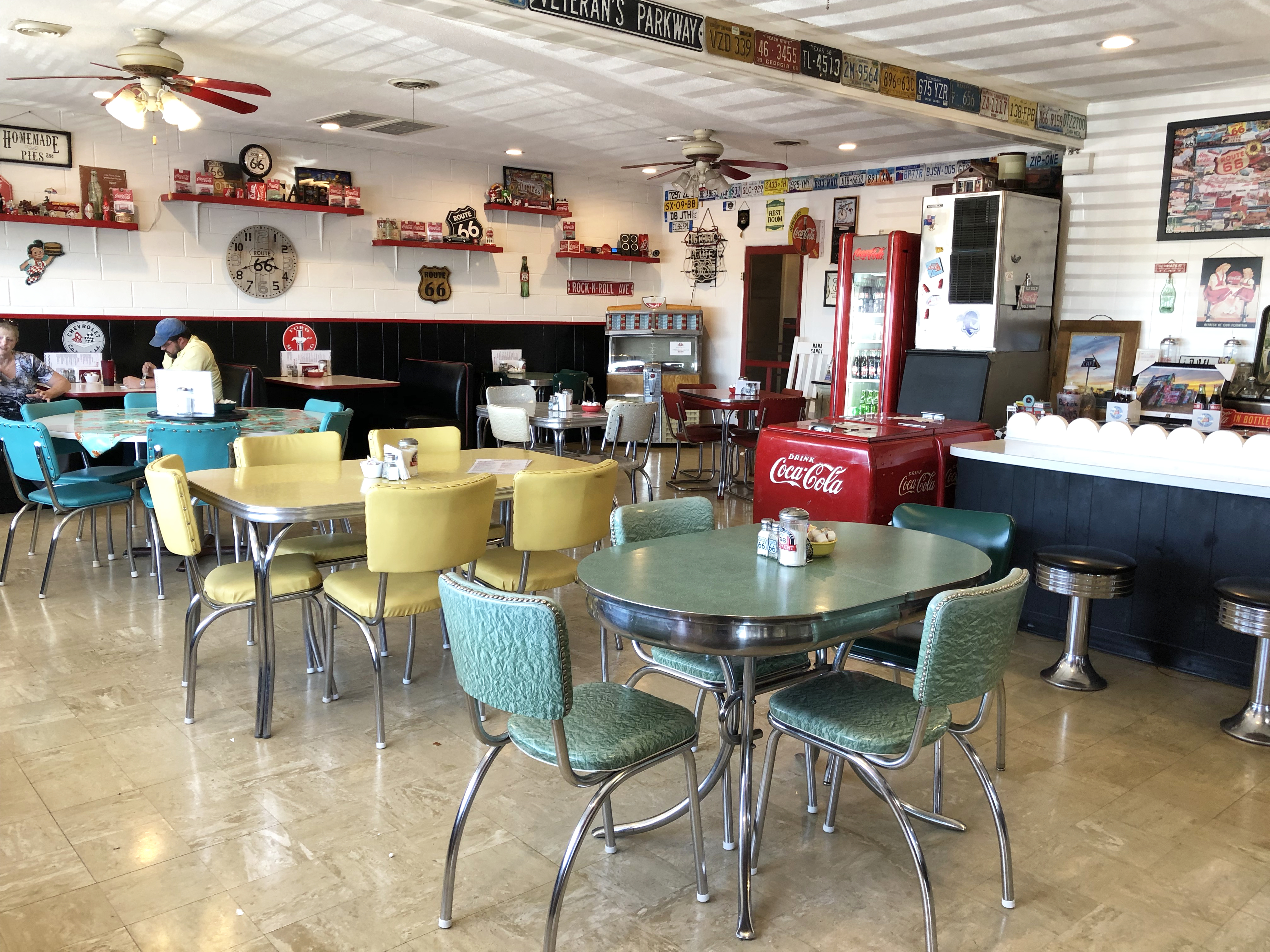
Now owned by Donna and Dennis Purschwitz, the Midpoint’s bright, cheery interior filled with retro chrome and Formica tables and shelves neatly filled with Route 66 memorabilia is probably one of the friendliest stops you can make on the Route.
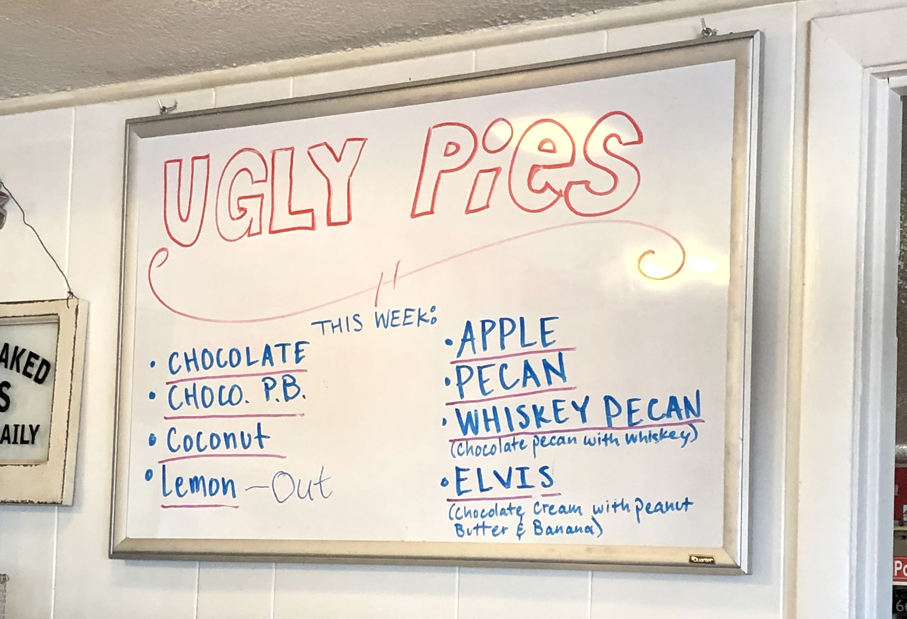
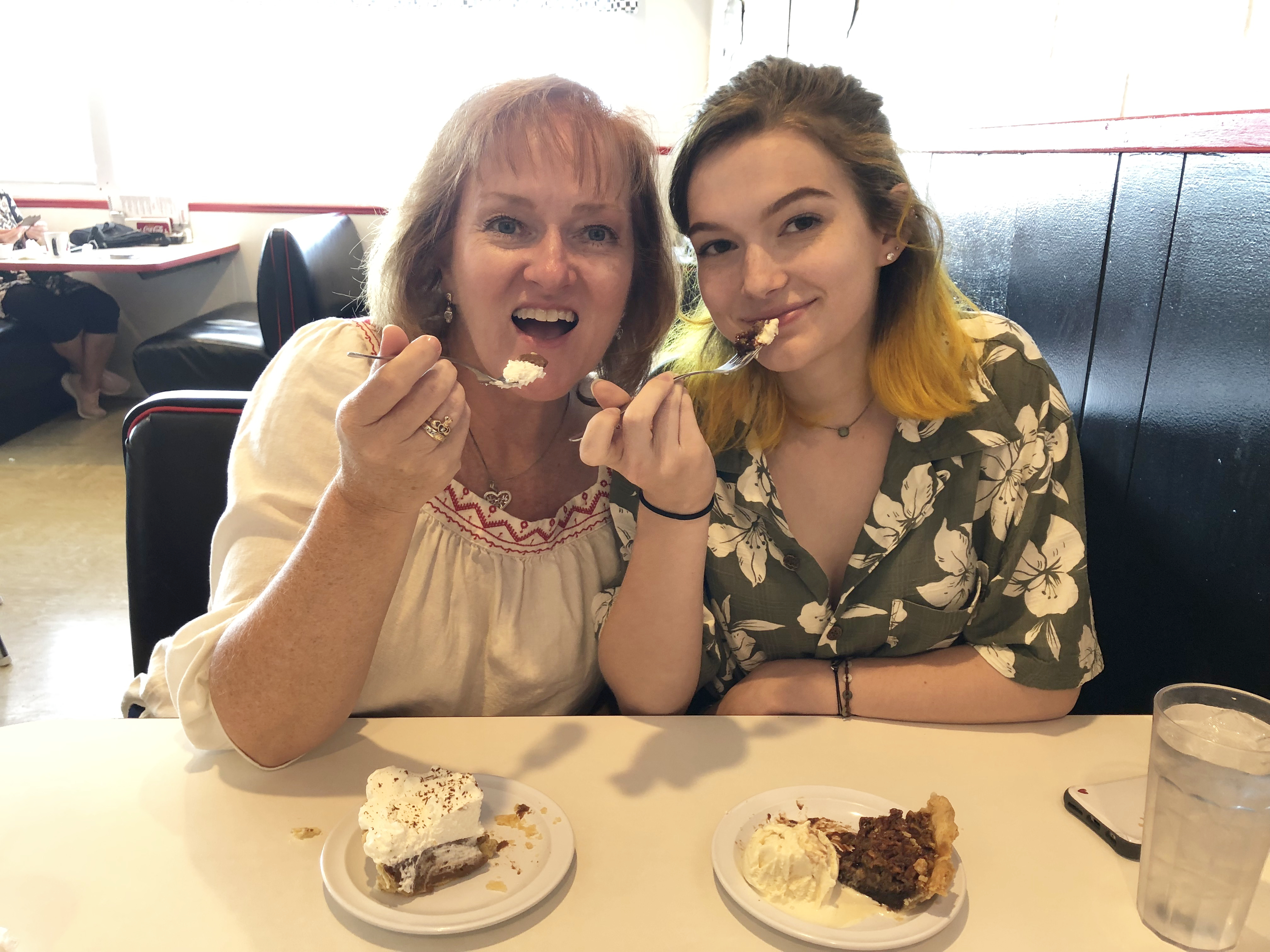
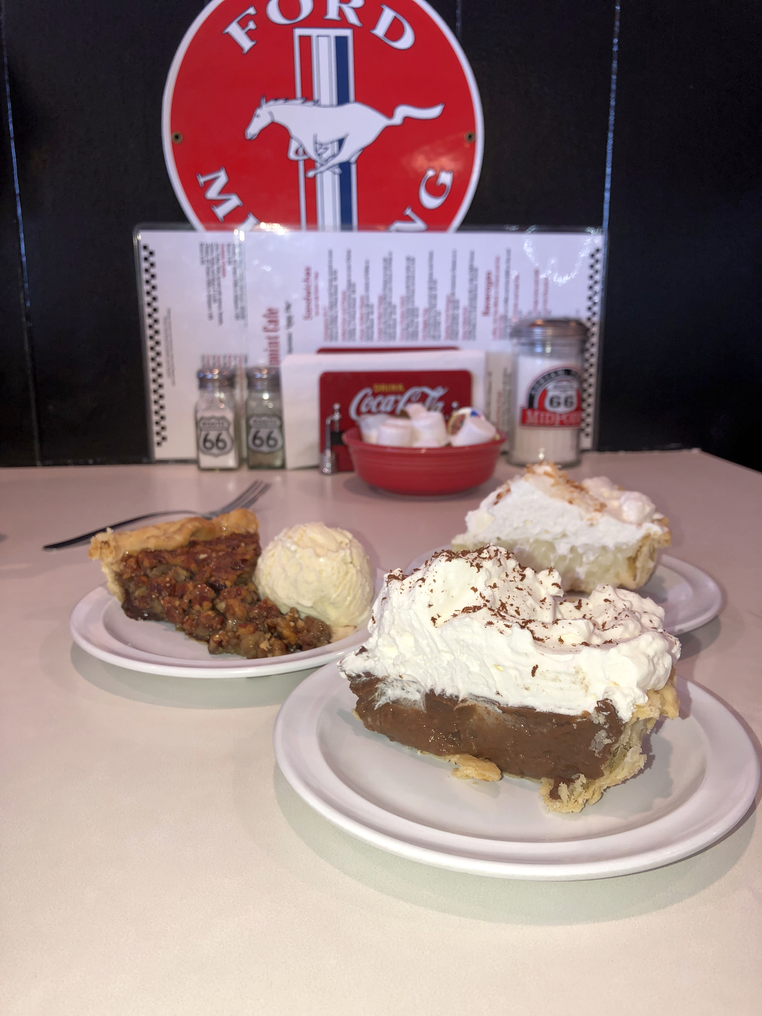
Though word has it their burgers are tasty, we’ll have to take others’ word for it because we didn’t arrive until 2:00…after the “grill was closed.” We were momentarily disappointed (and hungry!) until we realized they WERE still serving their famous “ugly crust” pies. Pie for lunch? Well…if we must!
Coconut cream, whiskey pecan (yes, you could taste the whiskey), and chocolate pie…just to make sure our bases were covered. A white board near the register lists your choice of “ugly pies” for the day, but one peek in the refrigerator case and you’ll want to run off with all of them.
The lesson here is, of course, to remember to double check their hours online if you head their way. Their Facebook page is: https://www.facebook.com/MidpointCafe/
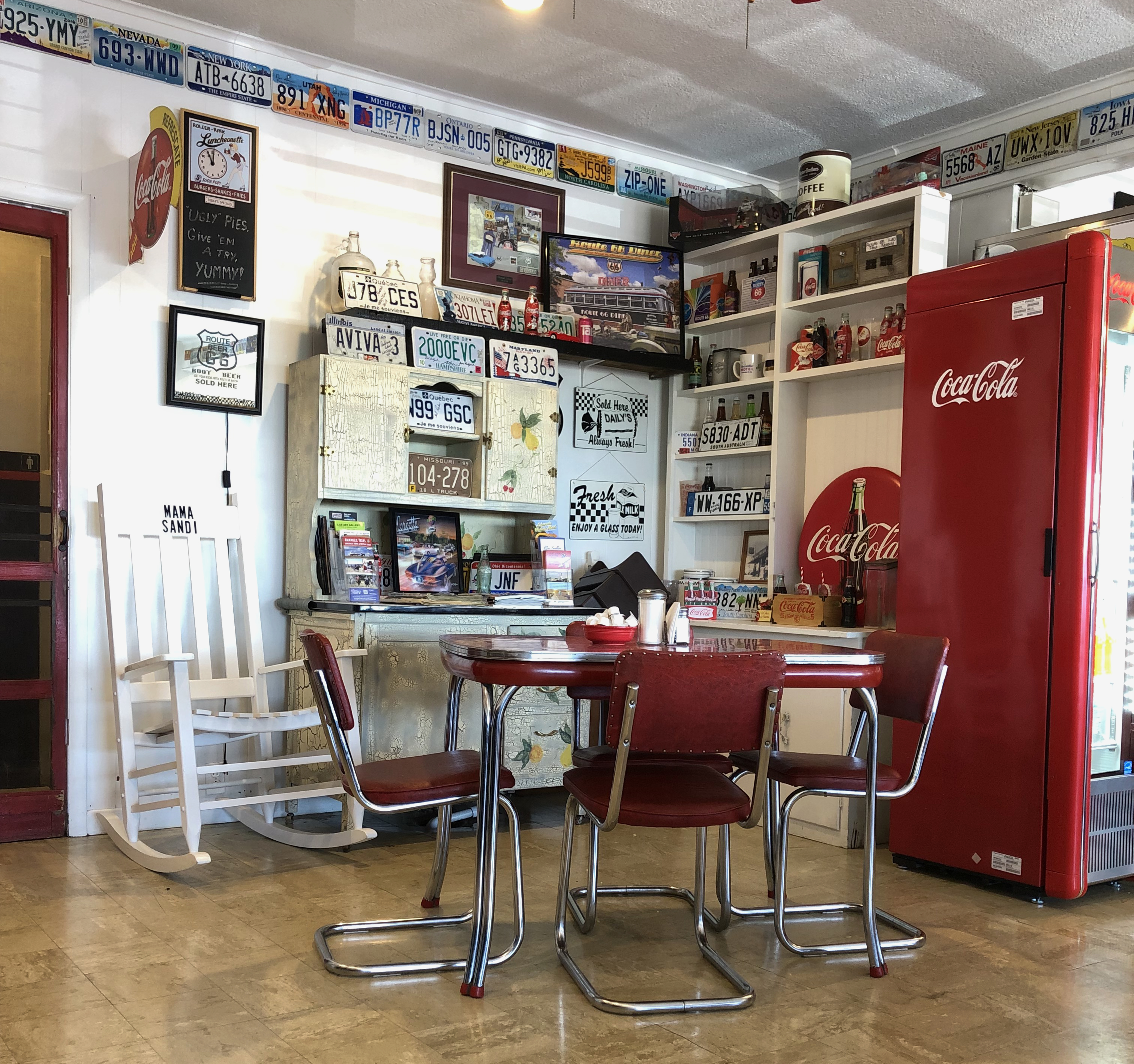
A rocking chair reserved for the mother of the family sits by a pie safe in a corner of the dining area to rest in after baking her famous pies.
The staff is relaxed and chatty, which encourages the patrons to make small talk with each other as well. We met several people from different countries there who were vacationing in America strictly to drive the entirety of Route 66. Everyone was in a great mood, because…pie!…and offered to take photos of each other in front of the Midpoint photo op sign across the street.
Can you tell it was windy?!
Inside the diner is a small gift shop with what we later realized were some of the cutest, most affordable Route 66 theme shirts and souvenirs. I couldn’t leave without a Midpoint Café shirt with a map of Route 66 on the back.
I look forward to going back one day and trying one of their burgers and, of course, more pie.
In my next post I’ll take you to another iconic stop just a few yards away. You won’t want to miss this one!
My last blog post about the stories behind the deserted buildings in the ghost town of Glenrio was about a dark occurrence in the local history. But these same buildings witnessed happy times, laughter, friendship and, occasionally, a heroic act.
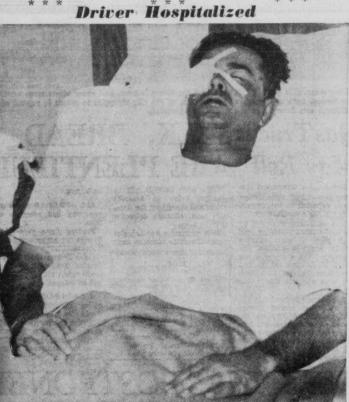
Thirty-eight year old bus driver John David Hearon braved a blizzard on foot for 8 hours to save his passengers, and his struggle came to an end in Glenrio.
At nine in the morning on a Saturday in February 1956, Hearon was driving 15 passengers from Amarillo westward in his Continental Trailways bus. Even though he was only driving 25 mph in the driving snow, the bus became stalled in a snowdrift between Adrian and Glenrio.
Because radios weren’t required on public buses at the time, (and obviously it was long before mobile phones) there was no way to call for help. There was half a tank of gas left to keep the engine running for heat, so Hearon decided to wait for assistance to arrive since the passengers were remaining calm.
The snow was soon piled waist deep.
Fuel began to run low about 2:30 p.m. and no search party had arrived. There was no food or water on the bus, and some of the passengers hadn’t eaten before leaving Amarillo (luckily, Hearon had).
He made the decision to go for help telling his passengers to stay together on the bus, and which way he was headed. Though he felt the Adrian might actually be closer, he headed west toward Glenrio to avoid walking uphill and into the wind.
The driver was only wearing his bus line uniform of trousers, a jacket, a cap, gloves and low shoes. As he began walking the snow quickly packed into his shoes and caked his pant legs before freezing into heavy ice. He later commented that though it made it more difficult to walk, the ice probably kept his legs from freezing.
He raised his jacket to cover his mount and nose for protection.
While it was still daylight he came across several stalled cars, three with people inside. He stopped to get warm in one before returning to his search.
After dark he could only tell if he had wandered off the road by the depth of the snow, and had to struggle to get back on it.
Hearon struggled on foot through the blizzard for eight hours and ten miles. When he would fall, he forced himself up knowing that his passengers were depending on him. He had lost all sense of time by the time he reached Glenrio, totally exhausted and suffering from frostbite.
Courtesy of Goole maps
The blowing snow hurt his eyes and he lost all sight in his right eye by the time he reached Glenrio. He could barely see out of his left eye, only being able to see the glare of light coming from Joe Brownlee’s gas station (the same station mentioned in my two previous posts).
He fell, exhausted, 1,000 feet before reaching the station, too weak to call out for help. He started whistling, which drew the attention of the men inside who hurried in to help him inside. They warmed him up and as soon as the ambulance arrived set out to find the bus.
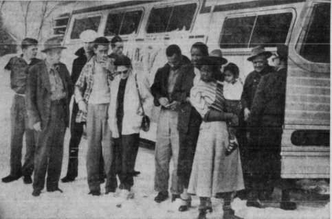
Brownlee was the first to arrive at the bus in his power wagon, and brought supplies for the passengers, who had been without food for half a day. The two sandwiches that were on board during their wait had been given to 21-month old Patricia Henderson, daughter of Ruth Henderson of Rayville, Iowa.
State police followed snowplows to reach the bus next, and rescued the passengers soon afterward. The bus was pulled from the snow with heavy equipment and driven to Glenrio, where the passengers were cared for and fed. By the time the passengers were rescued they had been stranded for 23 hours, but none required hospitalization.
They were driven to another bus in Albuquerque to continue their trip without ever having the chance to thank the brave man who risked his life to save theirs.
His doctors said that if he had ever stopped moving that it was likely he would have frozen to death.
While he recuperated in the hospital, his eyes covered in bandages, he recounted the experience to visiting journalists. He received cards and letters from all over the country.
Continental Trailways offered Hearon two extra weeks with pay, and the Treasure Island Chamber of Commerce in Florida provided he and his wife with a free vacation when he recovered.
After all this time, its unlikely that anyone seeing Brownlee’s abandoned station now remembers the story of the heroic bus driver who suffered through waist high snowdrifts to help his stranded customers.
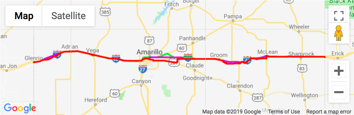
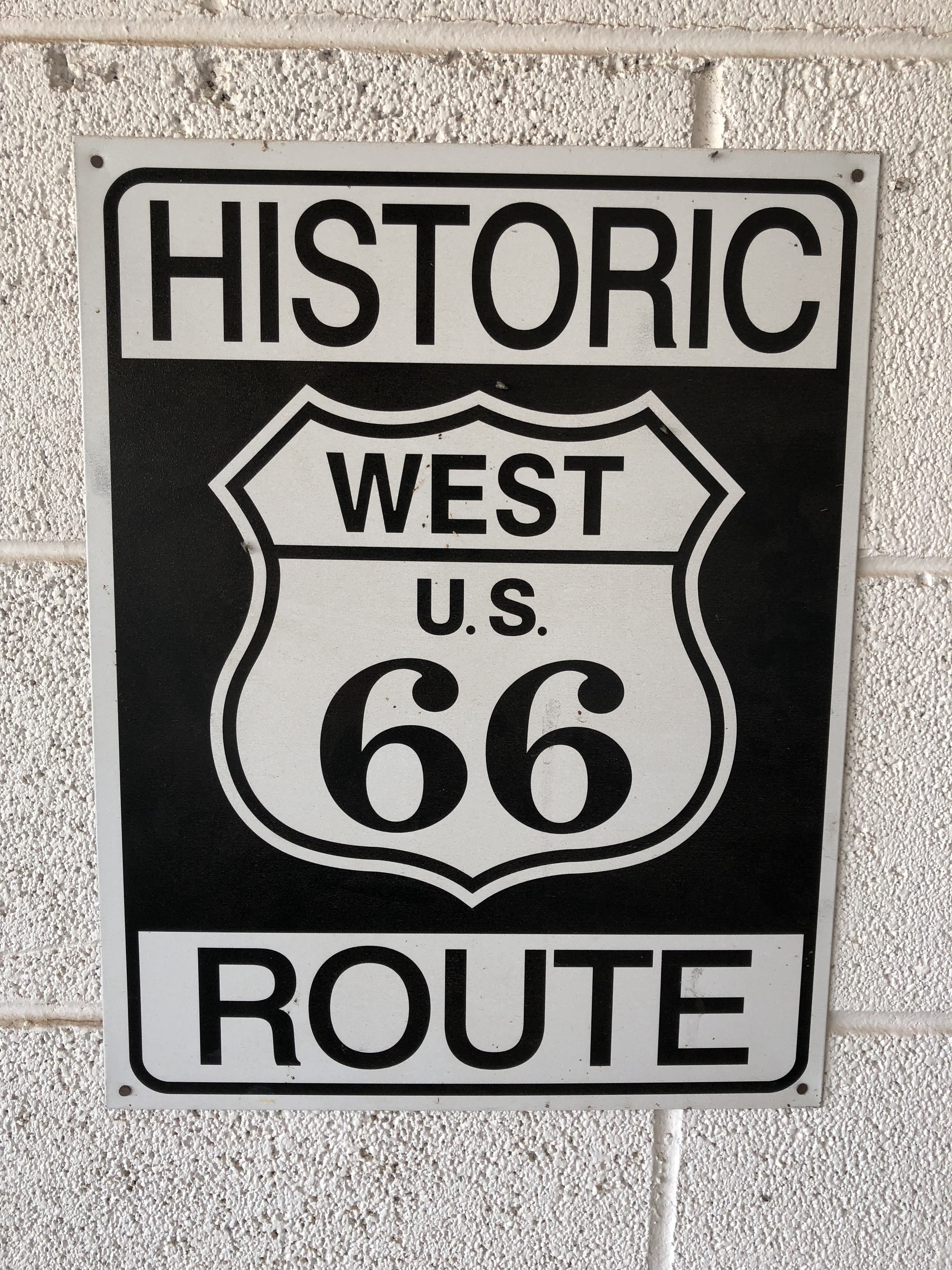
After spending the night in Tucumcari, New Mexico so we could get a “running start” at the stretch of Route 66 that cuts through Texas, we headed out to find our first bit of nostalgia.
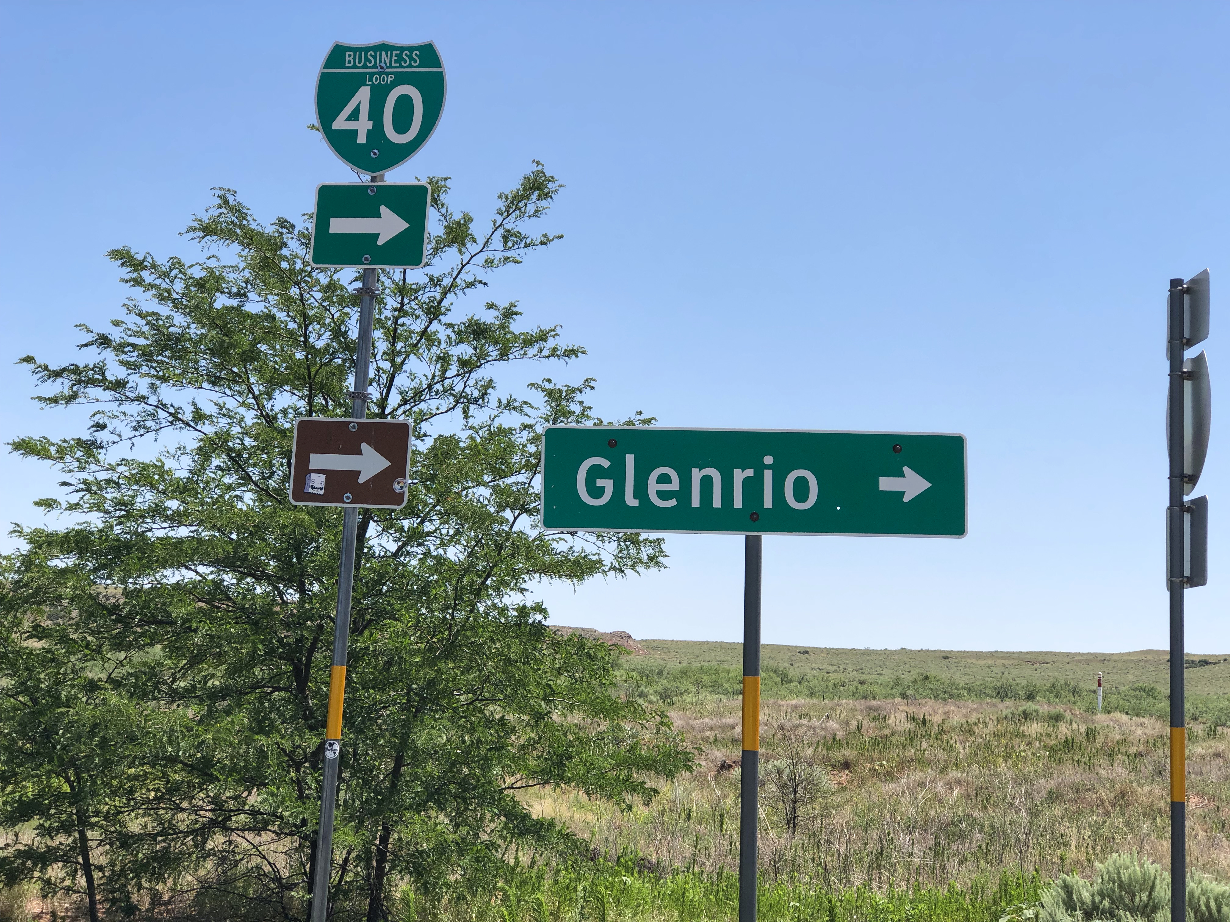
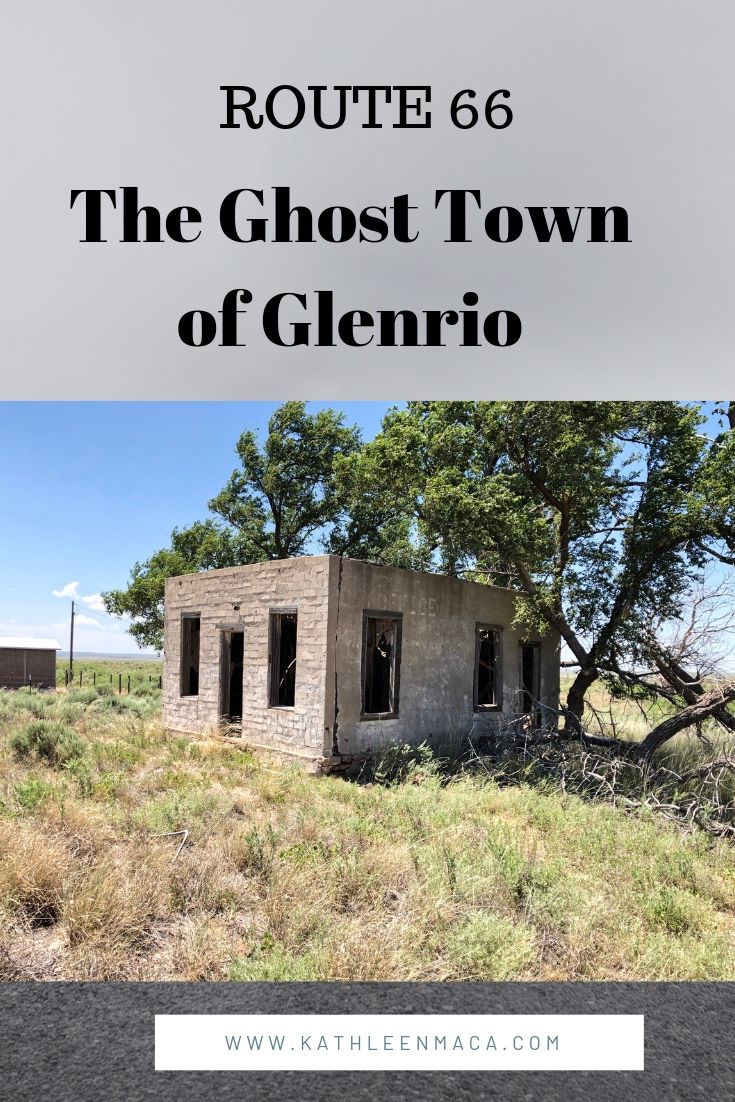
Glenrio is a town that’s actually in two states, straddling the border of New Mexico and Texas, so it was an ideal place to begin our adventure. Now a ghost town (although it still technically has two residents), it sits silently except for the hum of semis rushing down Interstate 40 just about 1000 feet behind what was once a popular stop along Route 66.
Crossing into the Lone Star State and Central Time zone, we took Exit 0 and two short right turns to end up on the original roadbed of old Route 66 that runs through town.
My heart raced a bit, because the crumbling bones of the few remaining buildings looked so familiar to me after doing much research for the trip. That’s when it hit me that we were actually doing this roadtrip I’ve looked forward to for so long!
Here’s just a bit of background on the town to put things in perspective (then we’ll get to the ‘good stuff!’).
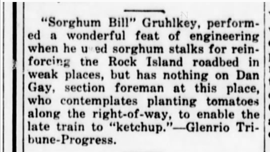
The town site was primarily populated by large cattle ranches, and then wheat and sorghum farms. Chicago, Rock Island and Gulf Railway established a station there in 1906, one year after the region was opened to small farmers to settle.
Humorous clipping from the Glenrio Tribune
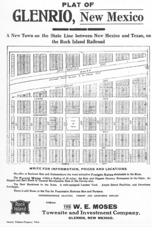
In September 1910, J. W. Kirkpatrick opened the first business in town, the Hotel Kirkpatrick. Other buildings soon popped up including grocery and mercantile stores, a bakery, a post office, the Glenrio Tribune newspaper (published from 1910-1934), a barber shop, a blacksmith shop, a feed store, a telephone exchange and a Methodist church. A school was added to the community in 1912.
In the 1920s the government improved the dirt road running through town by paving it and dubbing it as part of the Ozark Trails Highway. By then the town had added a hardware store, a land office, more hotels/motels, service stations and cafes.
Photo taken shortly after the road through Glenrio was paved.
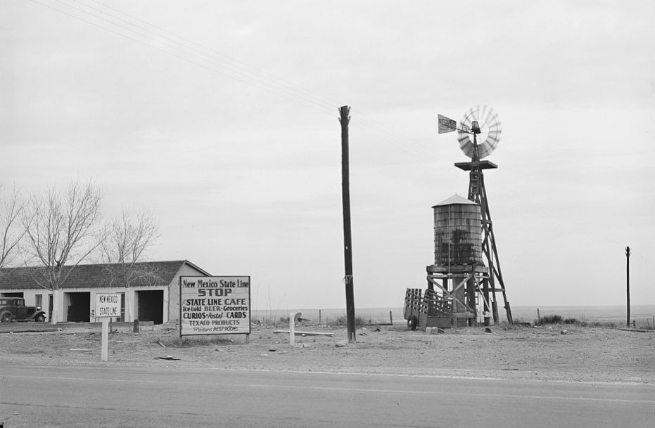
One of the amusing facts about Glenrio is how its businesses were divided by the states they sat in. Deaf Smith County in Texas was dry, so the bars and any establishment selling alcohol were built on the New Mexico side of town. No service stations were on the New Mexico side because of that state’s higher gasoline tax. Just a few steps along the road changed the laws and the prices.
The original Glenrio post office was on the New Mexico side, even though the mail arrived at the railroad depot on the Texas side. Years later a new post office was built on the Texas side.
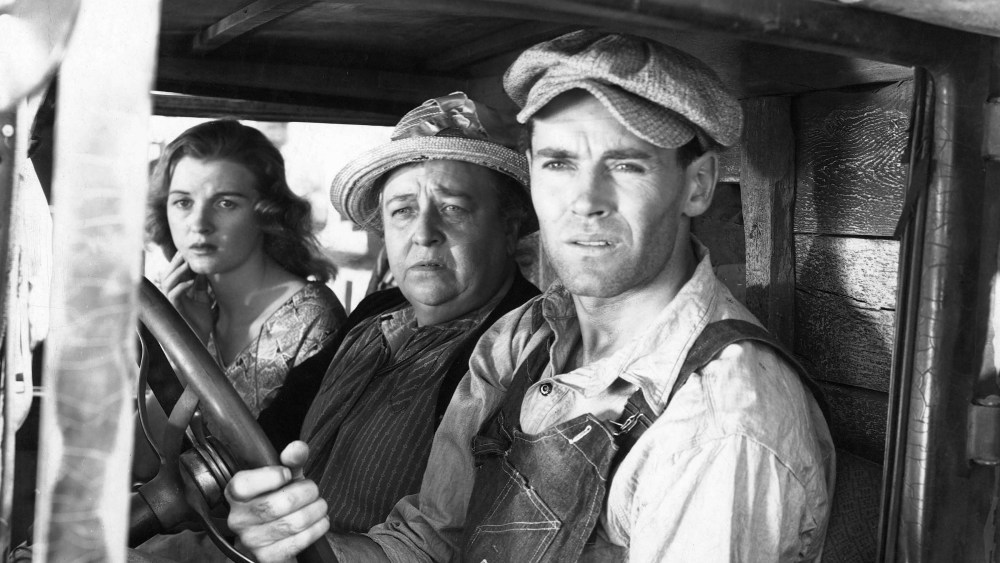
Photo by 20th Century Fox/Kobal/REX/Shutterstock
In 1940, just two years after the final pavement through the Llano Estacado terrain of Route 66 was finished, scenes for the movie version of John Steinbeck’s The Grapes of Wrath was filmed in Glenrio for three weeks. Pretty big excitement for a little panhandle town.
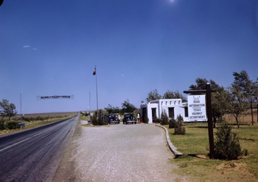
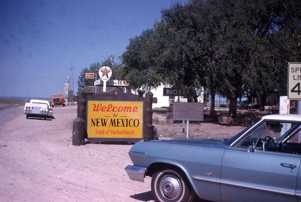
At the midpoint between Amarillo and Tucumcari, Glenrio became a popular stopping point for Route 66 travelers and a “welcome station” was built near the state line.
Glenrio Welcome Station on Route 66
The town’s population never rose above about 30 people. Most of the residents made their living from tourist based operations for Route 66 in the 1950s, but its popularity couldn’t save the town when Interstate 40 was built, bypassing the community.
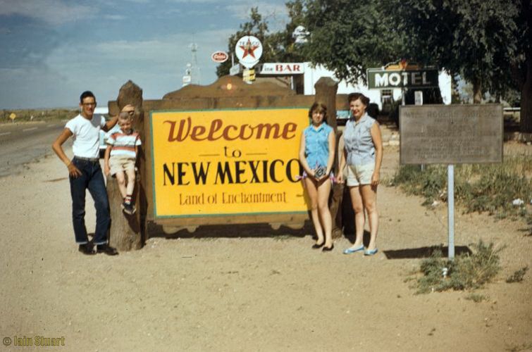
I can only imagine how many families took their “New Mexico photo” and then just steps away took the Texas version.
The Rock Island Railroad depot closed in 1955. By 1985 the Texas post office was the only business open, but it has now long been closed.
You’ll want to step carefully if you walk off the road toward the buildings, because the biggest population in this town just might be the snakes judging by the number of holes I saw in the dirt.
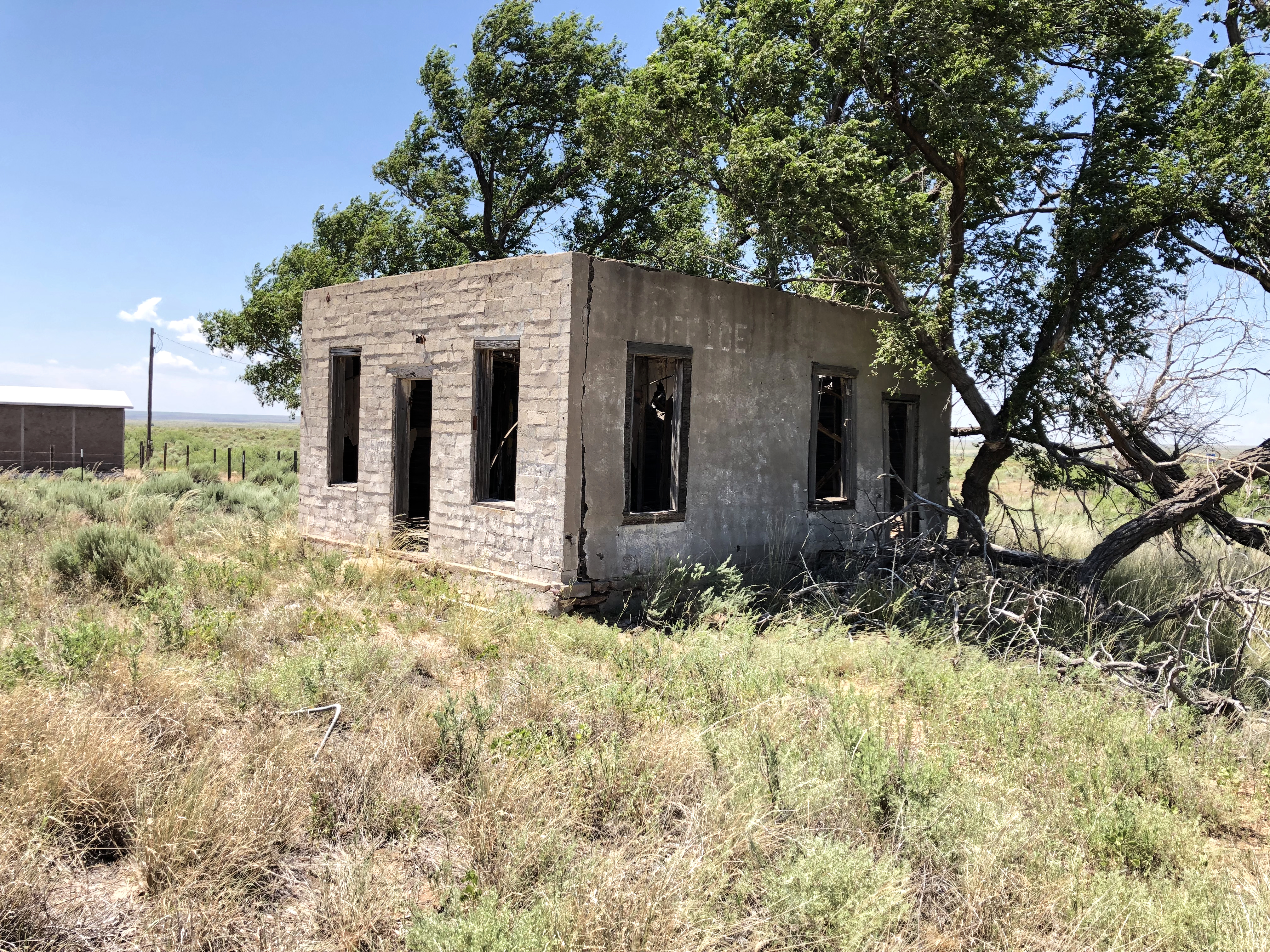
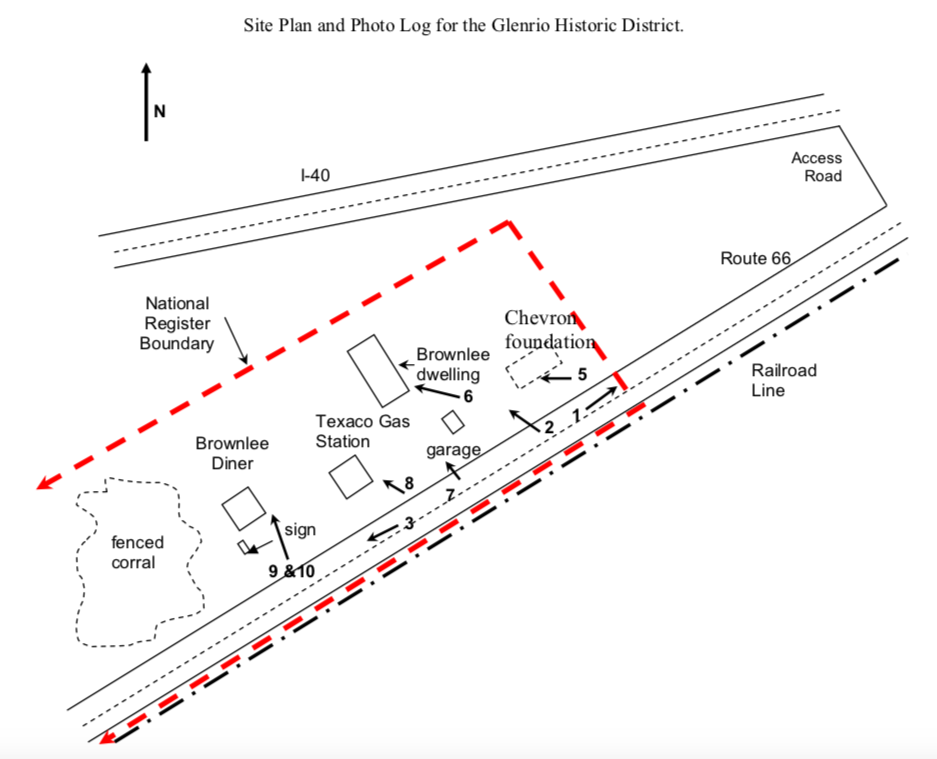
The remnants of the few buildings left standing each must have innumerable stories to tell, if only they were able. All of the remaining buildings are on the north side of the road.
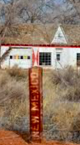
State line marker as it appeared just a few years agoState line marker as it appears today
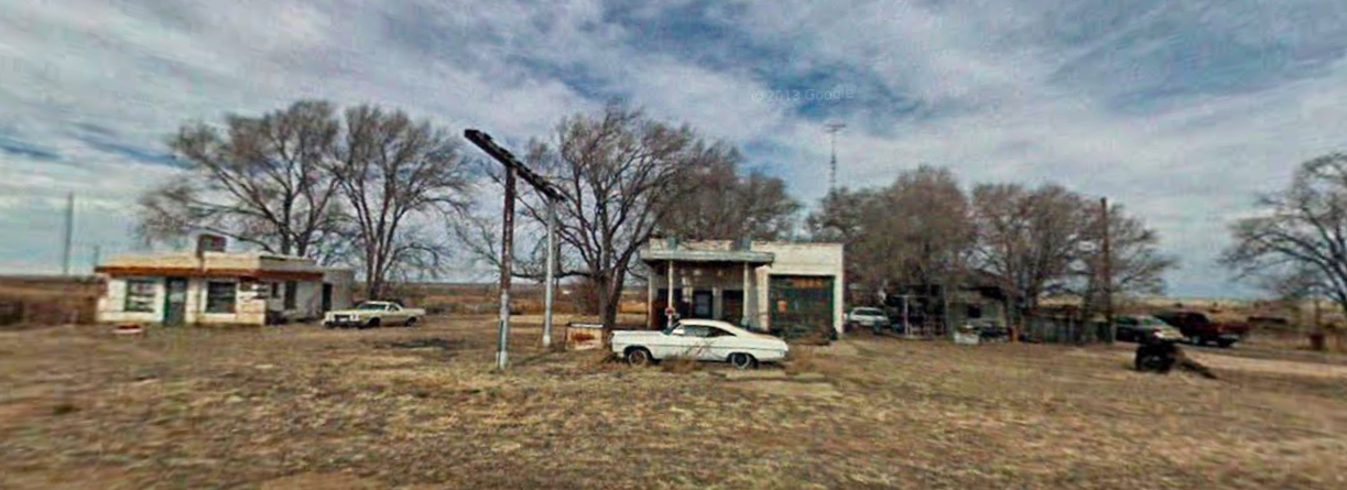
Texaco Gas Station and Brownlee House
Image via Google Maps
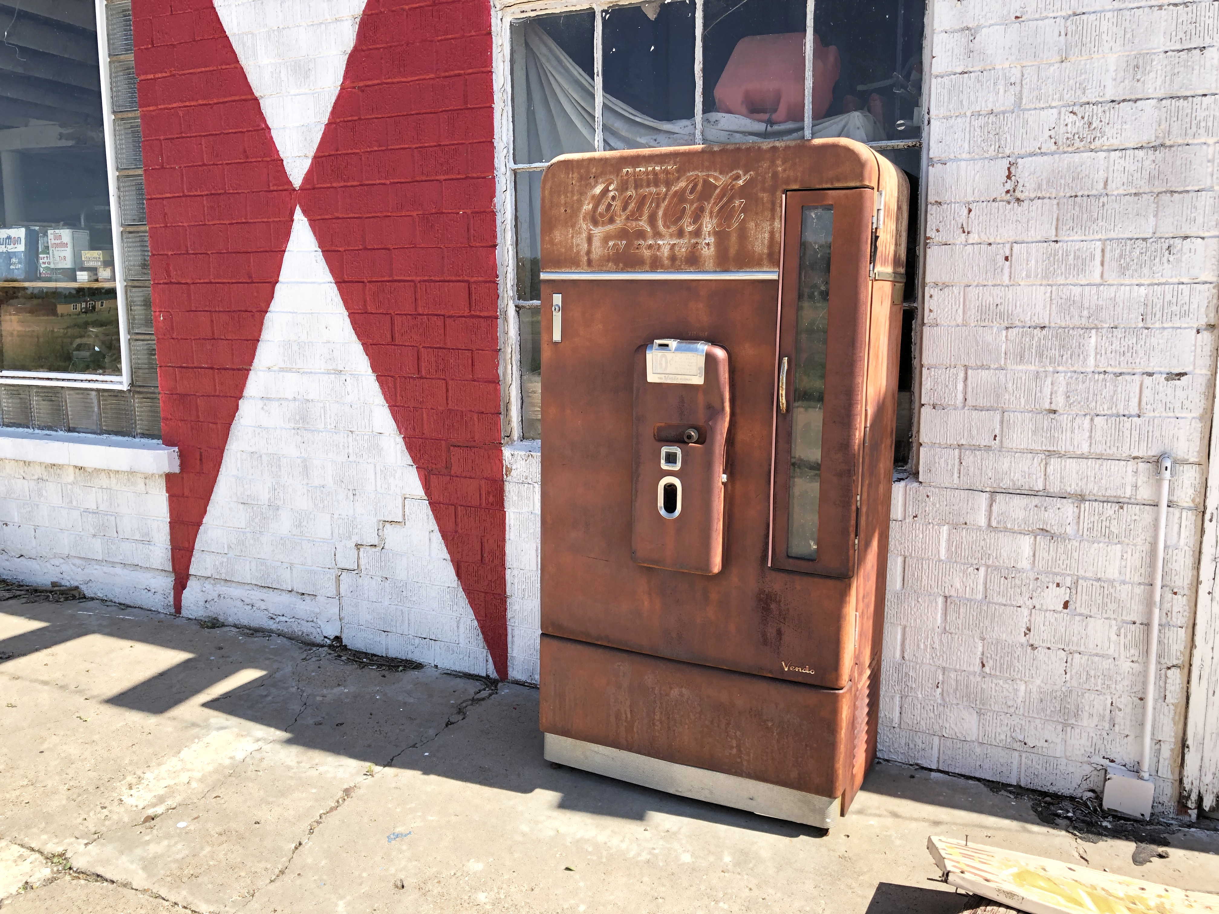
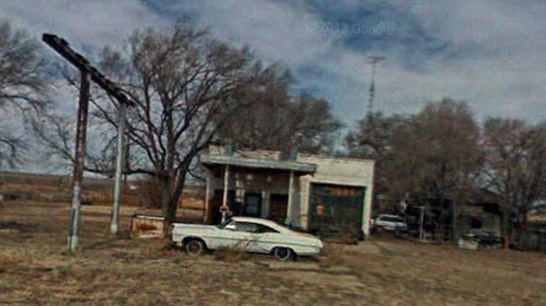
One of the first things visitors encounter is this old, abandoned Pontiac in front of a forlorn gas station. Thanks to the fascination for abandoned places and the internet, even those who haven’t visited Glenrio are familiar with the car. What most dod’t realize is that the classic automobile has a much darker story than most cars that are left in place to rust, but I’ll share that in my next blog post. (You can find the story here.)
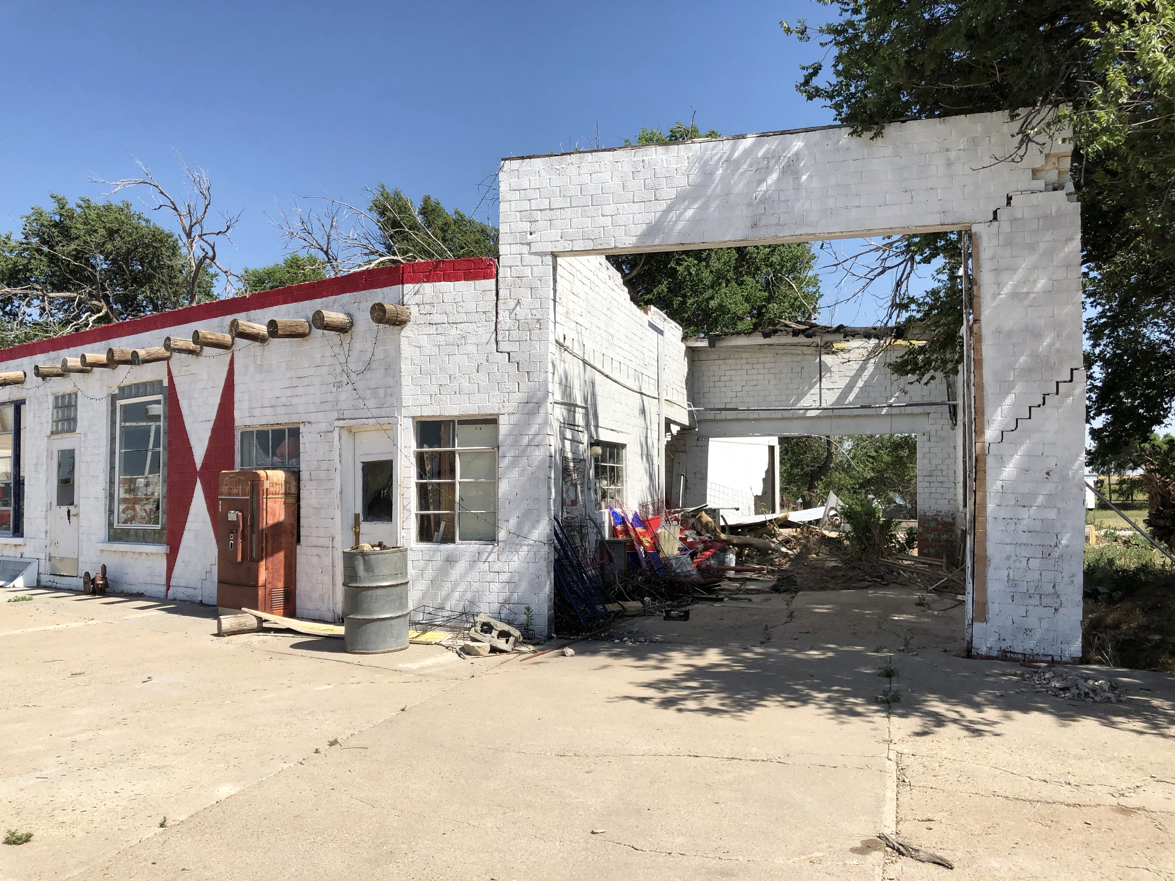
Built by Joe Brownlee in 1950, this Texaco station still sports its original gas pumps and front door, which is pretty amazing considering the harsh climate and years of abandonment. Because it was posted as private property and was in such close proximity to the Brownlee House, I respected the owners privacy by not venturing too close. But I sure WANTED to!
Joseph (Joe) Brownlee House
Sitting about 40 feet in back of the station is the Joe Brownlee house. Originally built in Amarillo ca.1930, he moved the bungalow style home to this location in 1950 to inlaced wrought iron porch posts and a faux stone veneer.
Roxann Travis, daughter of Joe Brownlee still resides in the home, and if you hear dogs barking when you step out of your care…they’re hers. It’s pretty fascinating to think of her living her entire life in Glenrio.
An interview once quoted Roxann as relating that, “My father had two gas stations here. Traffic would be lined up both directions. He’d have all five of us kids out there washing windshields and changing the oil so all they had to do was pump gas and keep moving them through as fast as we could.”
“We used to keep horses across the road but it was hard to get to them there were so many cars. When my kids were being raised here, they played ball on the road. You could take a nap on it now.”
West of the house is a picturesque horse corral made of native wood, and a handful of agricultural buildings.
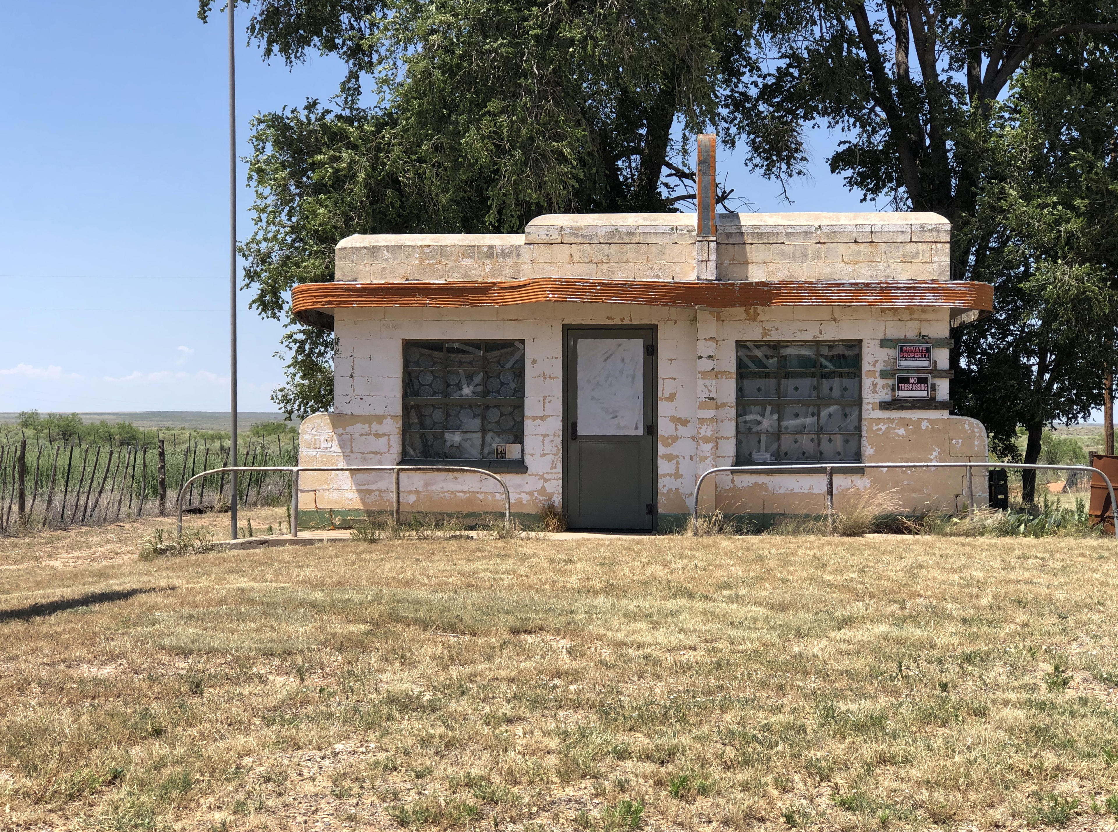
Brownlee Diner / Little Juarez Cafe
This little Streamline Moderne building sits just west of the Texaco gas station. It housed the Brownlee Diner, later known as the Little Juarez Café. It served its last meal in 1973.
The curved aluminum sign panel on the roof has the barely discernible word “Diner” visible on each side. On the east side I could barely make out the outline of a Mexican sombrero with the words “Little Juarez.” Photos that I’ve seen of the diner from as few as five years ago show the lettering quite a bit more clearly. Panhandle weather is a tough beast.
How the abandoned diner appeared in 2013. You can see more of the original sign paint still existed.
The windows were covered from the inside (no peeking allowed, evidently!), so there was no sense in disobeying the ‘No Trespassing’ signs posted all over the property.
But the little building does have quite a modern day claim to fame…
Does this look familiar from the movie “Cars?” Yep, it was the inspiration! The animators for the movie actually traveled Route 66 and used many of the roads iconic sites in the film.
From the movie “Cars”
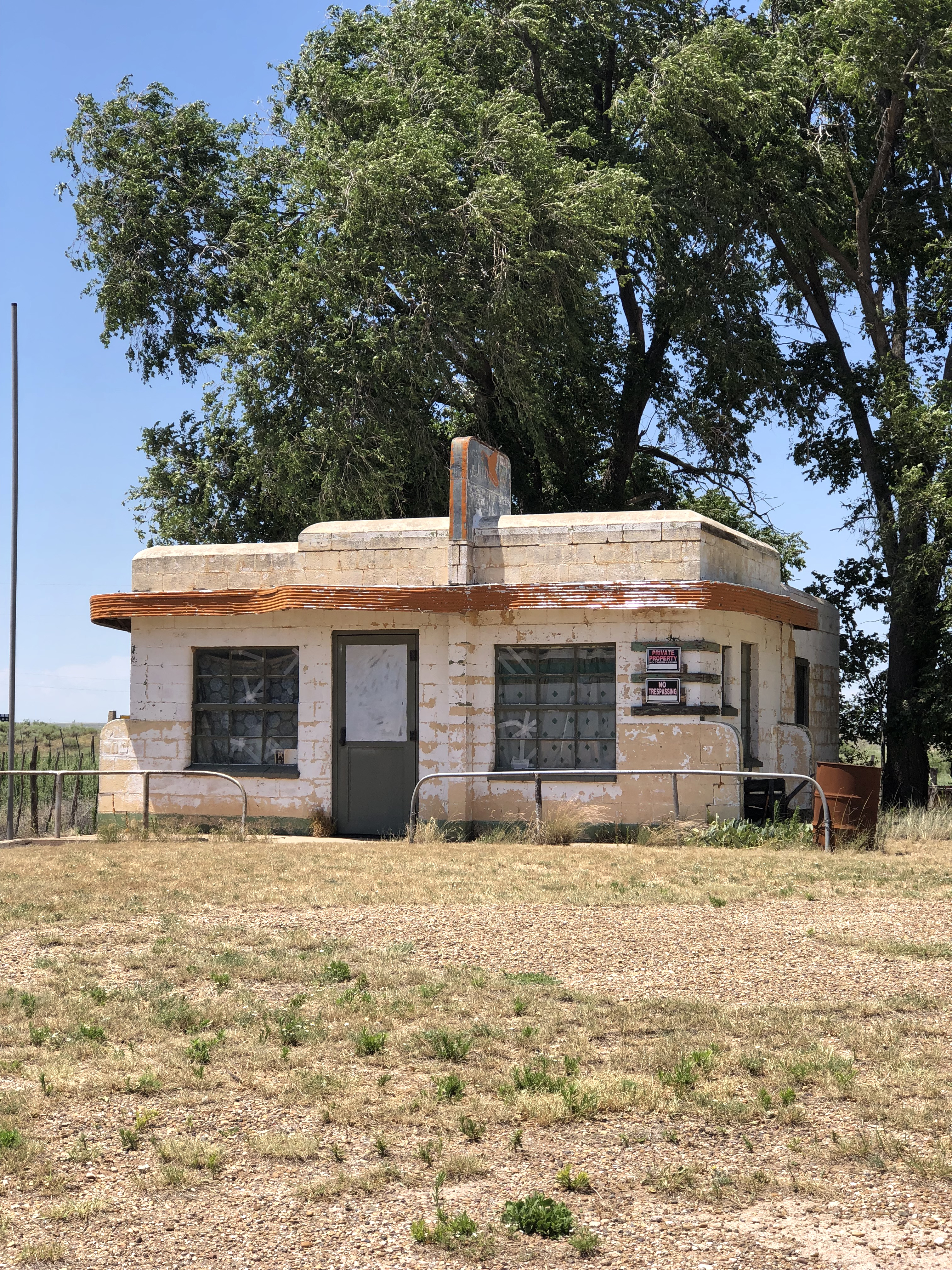
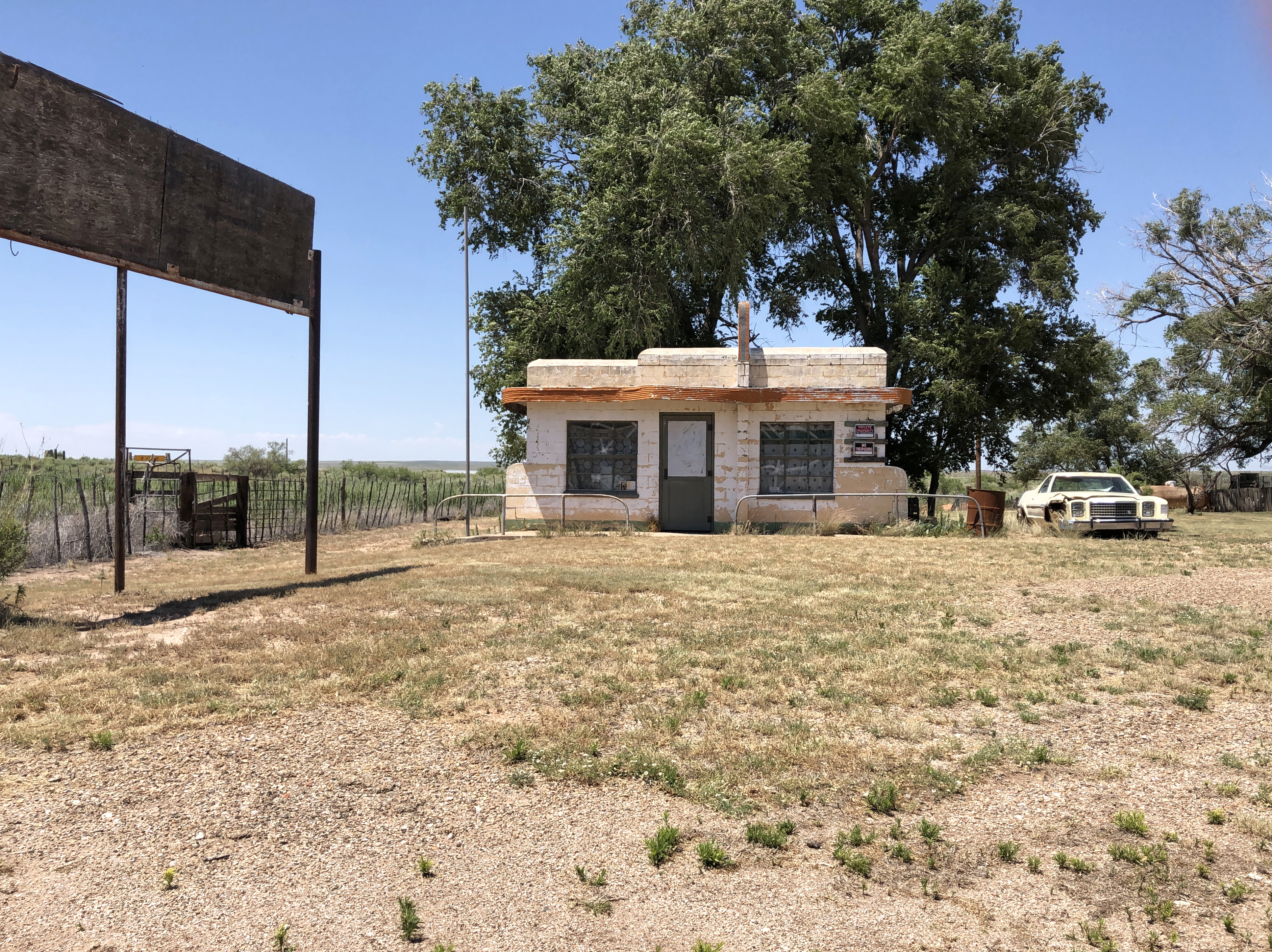
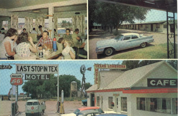
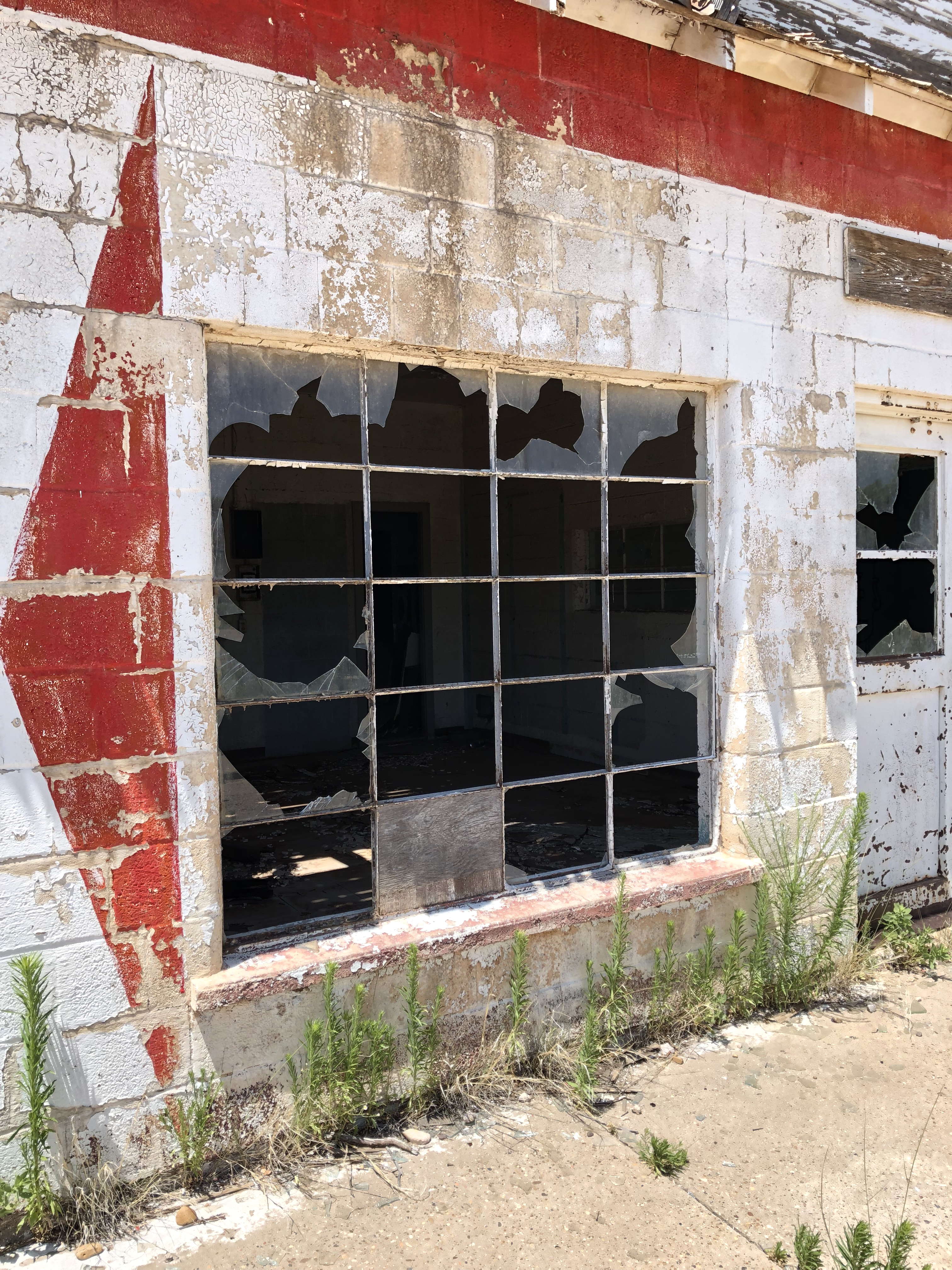
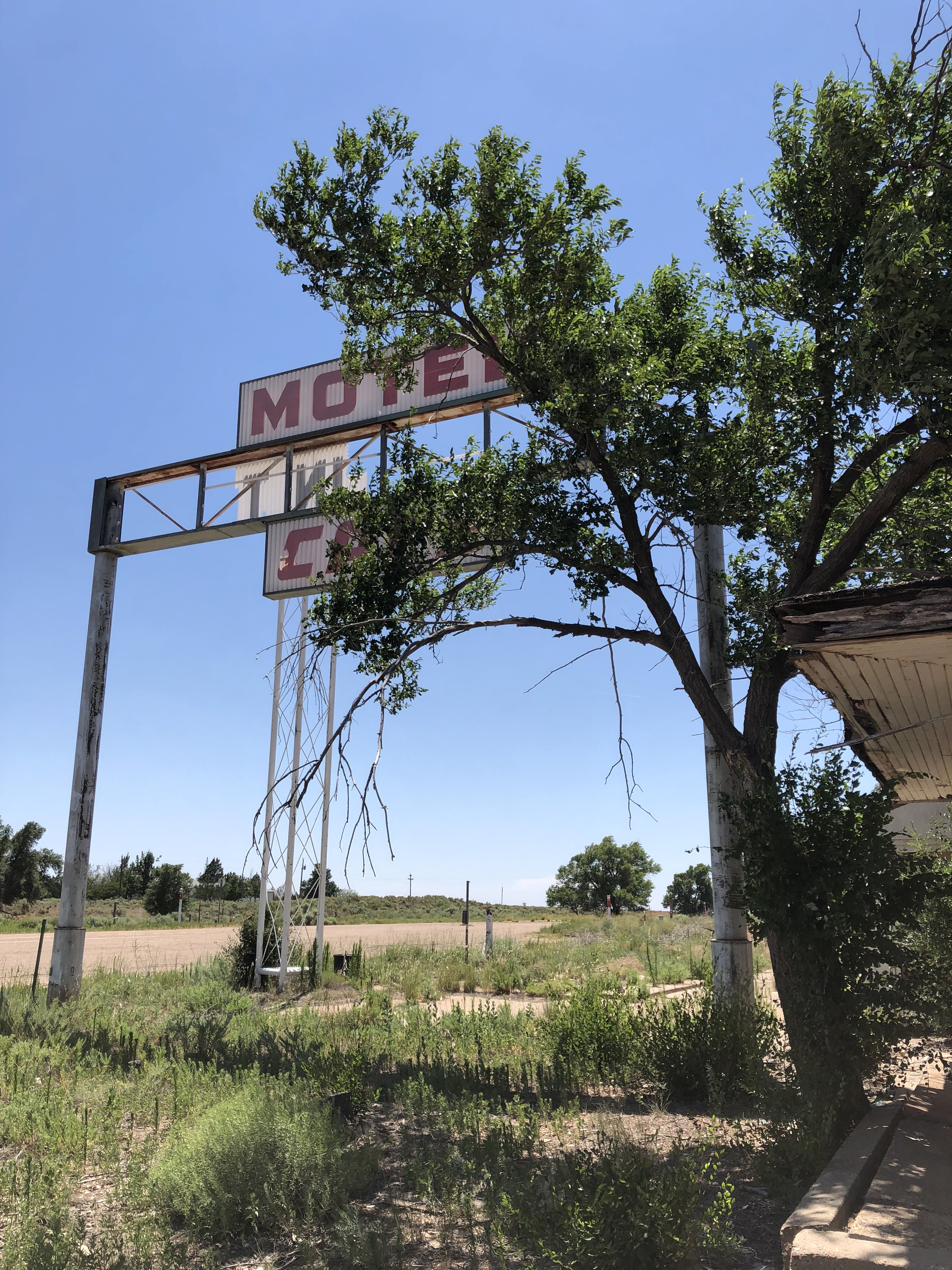
Texas Longhorn Motel, and the State Line Cafe & Gas Station
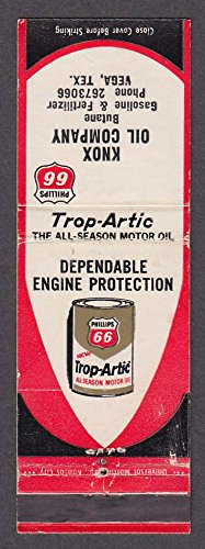
In 1939, businessman Homer Ehresman purchased the State Line Bar and operated it for several years before selling the property to Joseph Brownlee. In 1953 Ehresman constructed the State Line Café and Gas Station just east of his former property on Route 66.
1965 postcard of the Longhorn
The one story building housed both the cafe and gas station, and a garage bay for auto repairs was on the west end of the structure. Not surprisingly, none of the twenty-light glass panels in the original bay doors are intact. An original hydraulic auto jack sits inside.
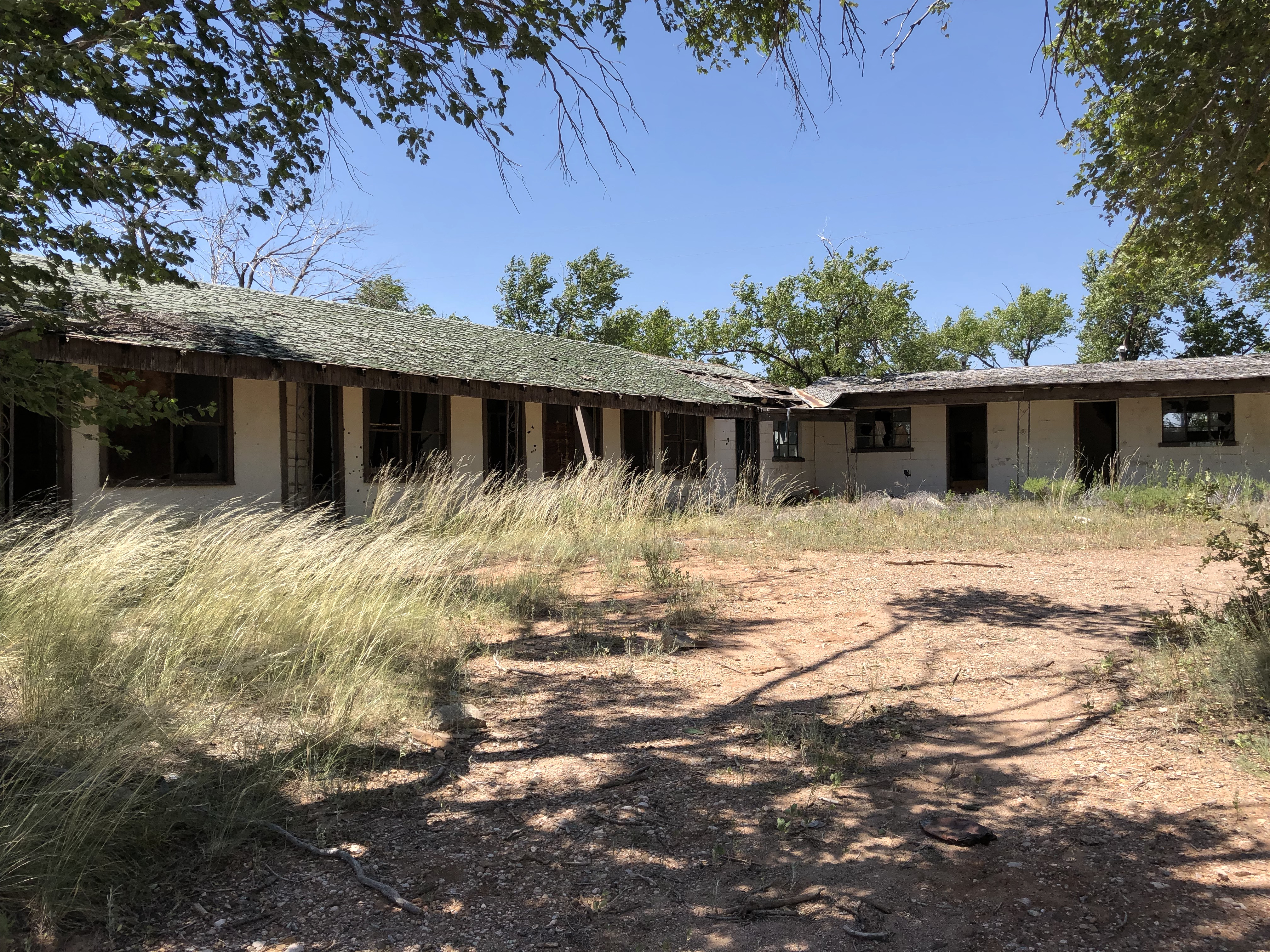
In 1955 the Ehresman family opened the Texas Longhorn Motel directly in back of their gas station and cafe, which was in operation until 1976. The U-shaped motel featured side eaves supported by wrought iron posts to provide guests shade on the walkways in front of the rooms.
As I walked into the center court of the motel (it was difficult to imagine it filled with autos at one time), I could easily see that the “U” was composed of two sections.
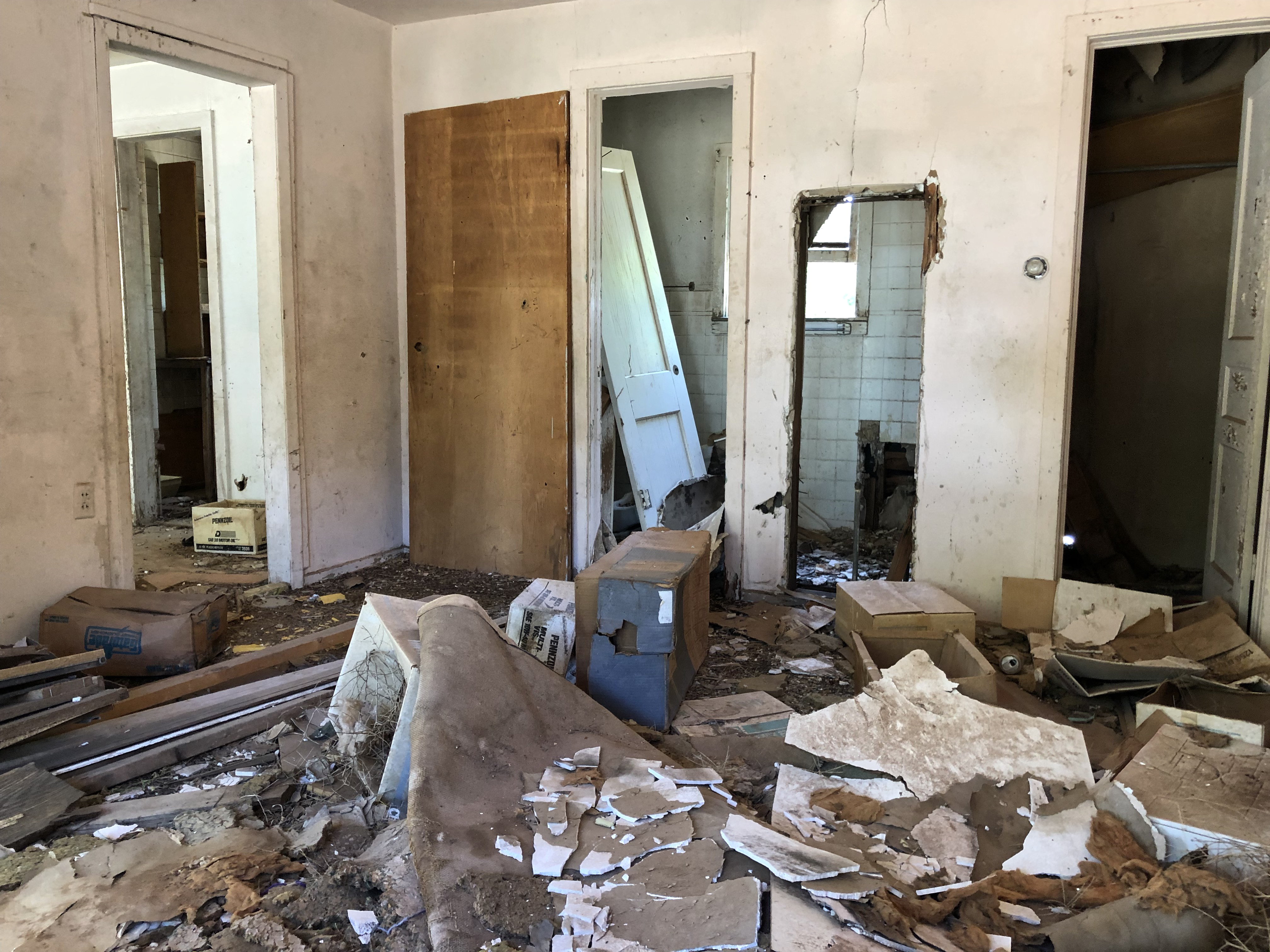
The wing to my left (on the west) housed five rooms of stucco construction, and had most of its original doors. I was surprised to find that each of the rooms once had small kitchens in addition to a sitting area, bed area and bathroom. Though some of what must have been original furnishings were inside, they were covered with crumbled drywall from the ceilings and walls.
The eight rooms at the back (north side) of the court appeared to be more simple, with a bedroom, bath (much of the original tile in place) and closet constructed on concrete block.
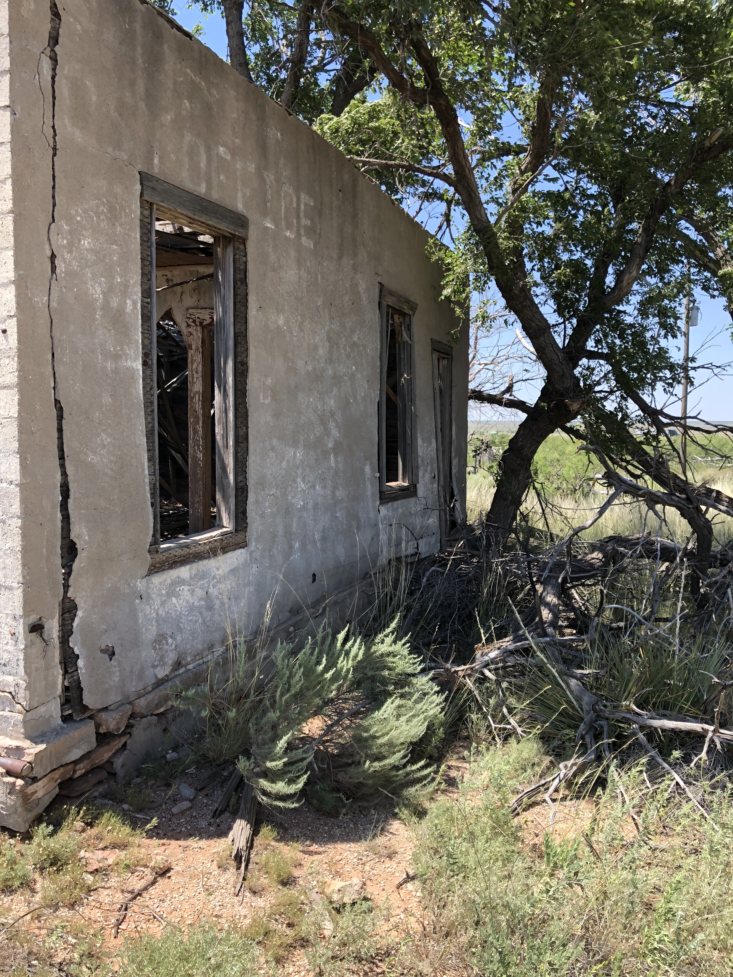
A detached office wing to the right (east) also providing living space for a manager, and was apparently occupied once again as recently as five years ago. Even then the condition of the building would have been rough, to say the least. Whoever lived there seems to have left their furnishings (or those provided to them) behind.
The most recognizable feature of the property to Route 66 afficiandanos is what is referred to as the towering “First-Last Sign” built directly in front of the buildings in 1955. Considered one of the most popular novelties along Route 66, it originally read “Motel – First in Texas – Cafe” or “Motel – Last in Texas – Cafe” depending on which was motorists were driving. A line of cars waiting for the pumps was a daily sight during the Route’s heyday. Now the only cars in in sight are ones that haven’t run for years, and the famous sign sits deteriorating. Soon none of the words will be left.
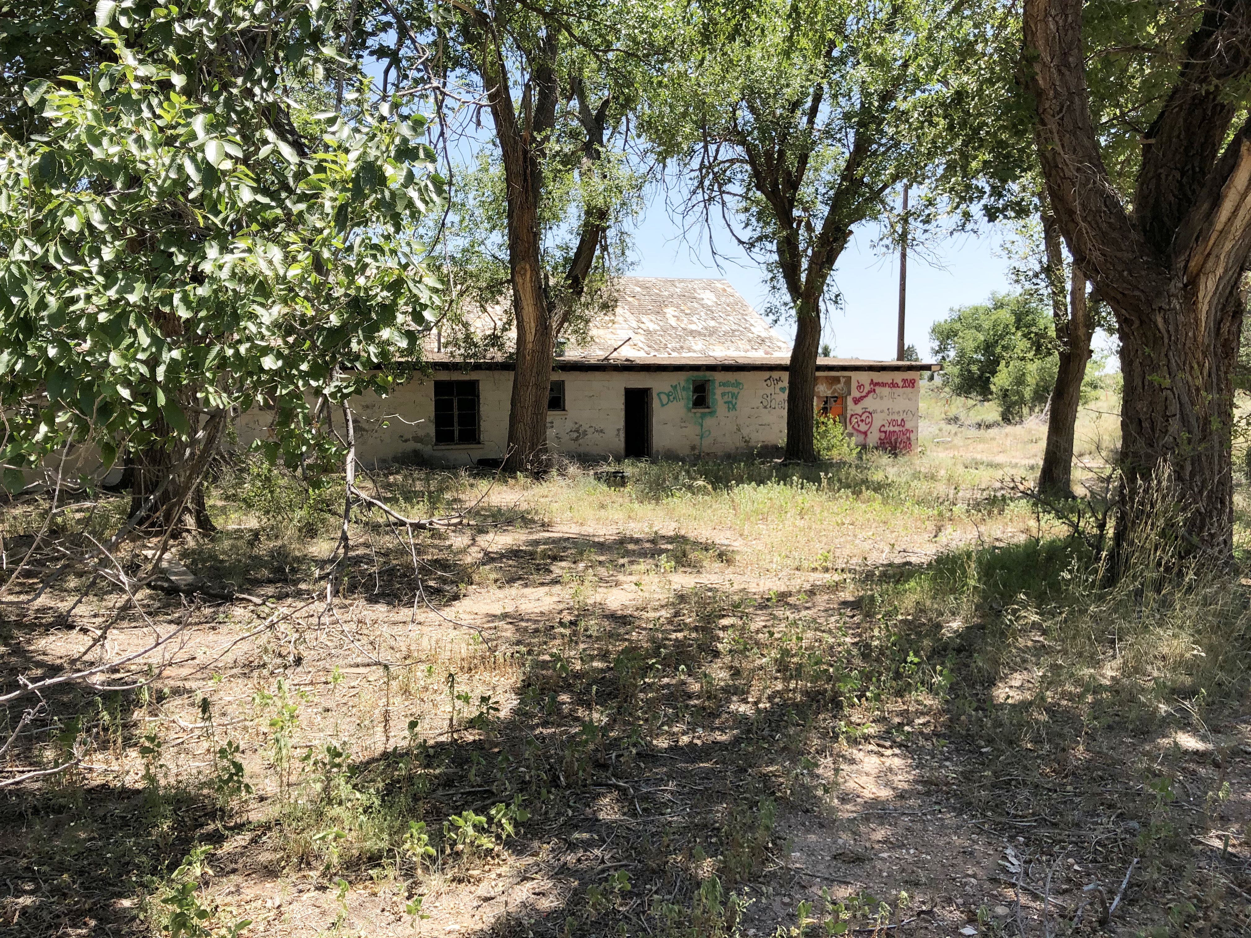
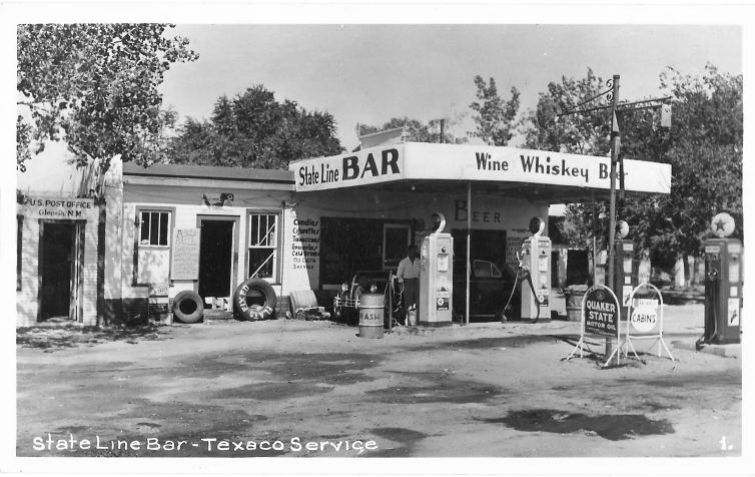
State Line Bar & Motel
Vintage photo of State Line Bar and Gas Station
The State Line Bar and Texaco gas station (gee, all the “necessities” in one stop!) was built about 1935 by John Wesley Ferguson who originally came to Glenrio to be the Rock Island station master. It was remodeled in 1960 with a concrete block exterior and aluminum and glass door. The little wooden lean-to building in the left of the old photo above (taken ca. 1950) functioned as the New Mexico post office.
Peering inside you’ll glimpse the caved-in ceiling, and pieces of carpeting and wood paneling. Other than that and some refuse there isn’t much to see.
State Line Bar
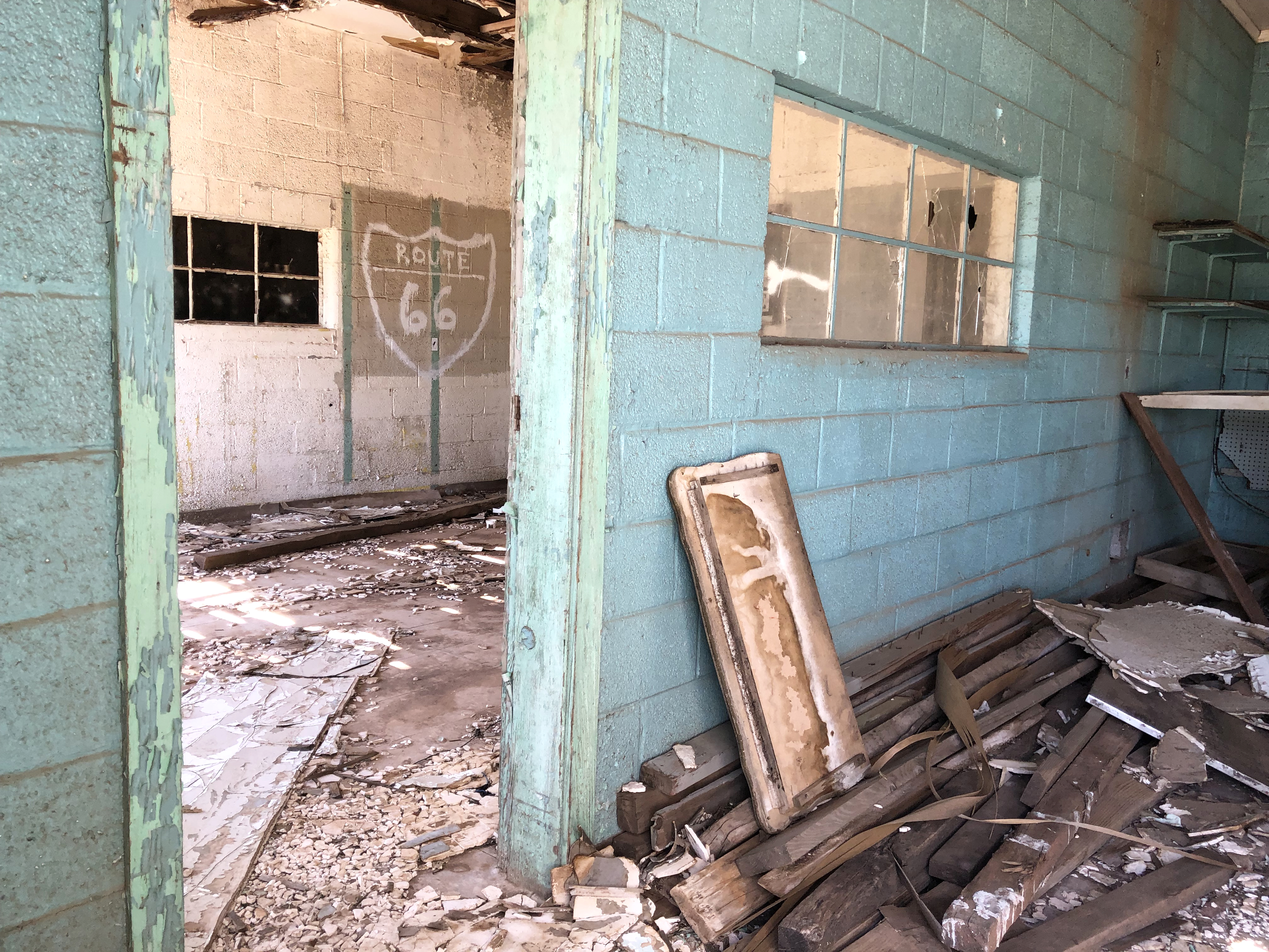
To the northwest of the bar is an abandoned eight-unit adobe motel built ca. 1930. The main façade has nine entrances, with eight opening to guest rooms and one to a storage area. A concrete sidewalk runs across the front of the motel in front of the warped, three-panel doors and each room has a window whose glass has long since disappeared.
To walk far enough back on the lot to reach the rooms, you’ll want to be wearing boots or snake guards because . . . well, yeah. The nearest hospital isn’t exactly around the corner.
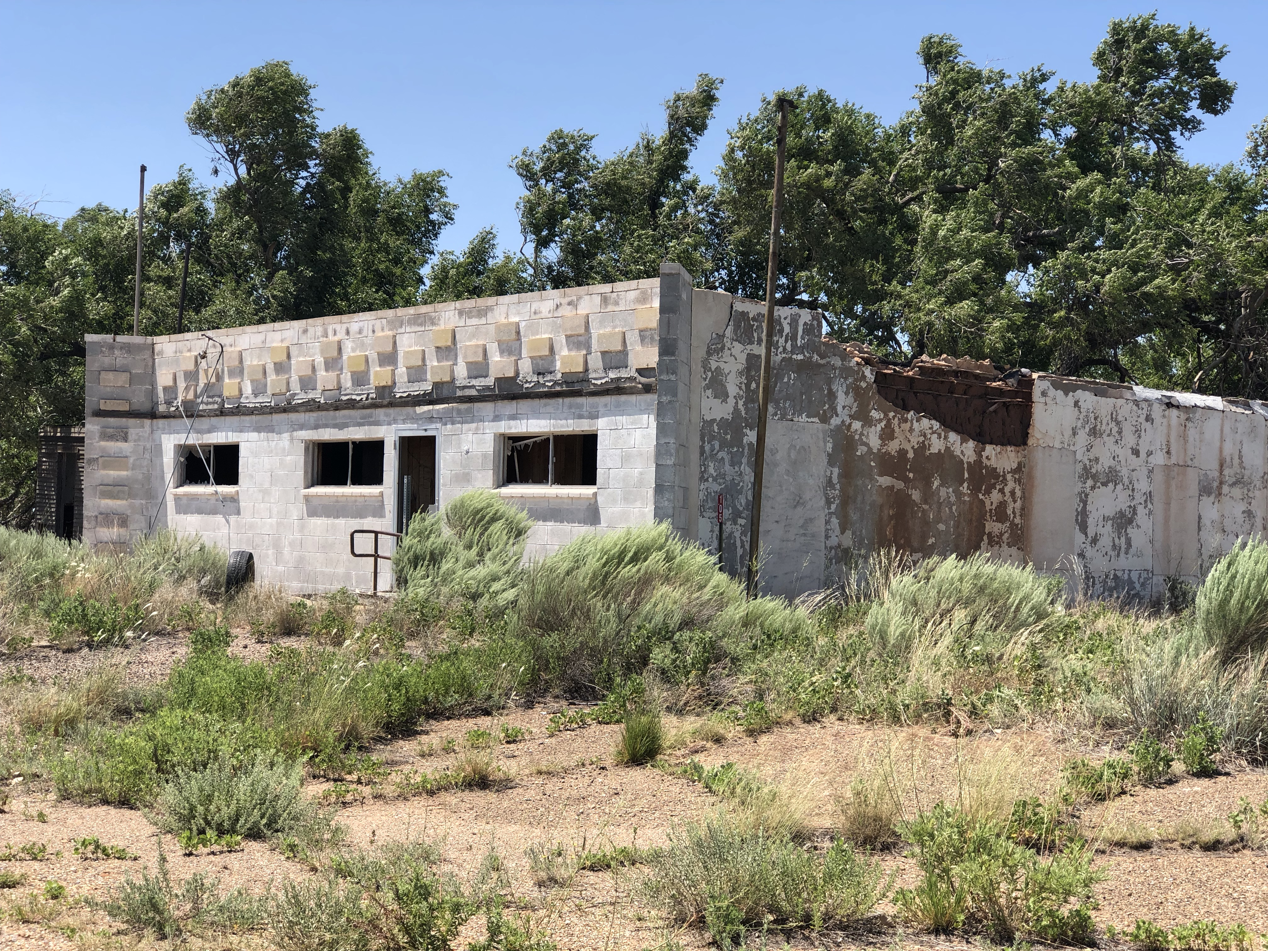
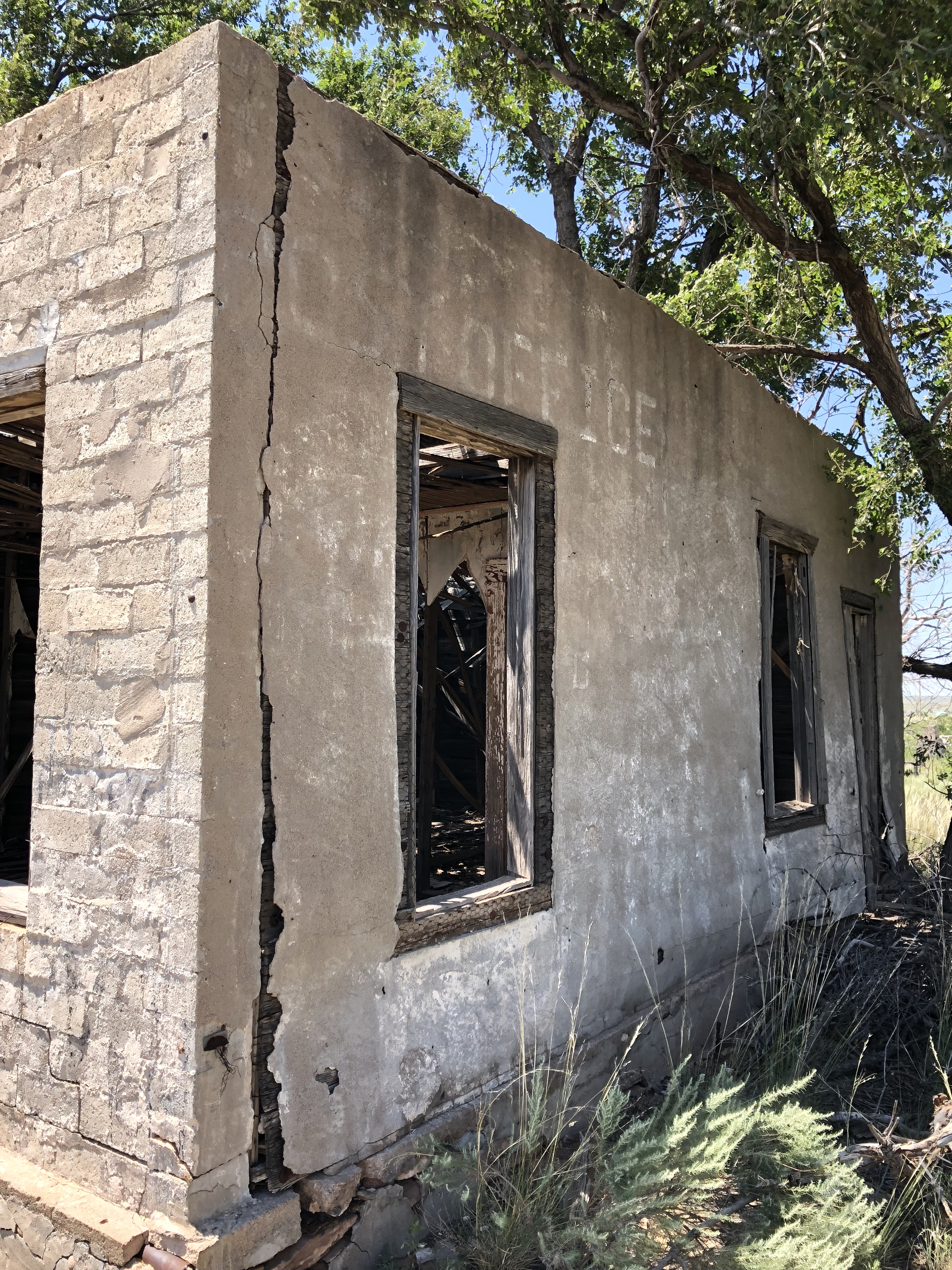
Ferguson (Mobil Oil) Gas Station & Post Office
This charming little concrete block and stuccoed wood ruin was originally a Mobil gas station built in 1946 by John Wayne Ferguson, Jr. Its missing all of its doors and windows, which makes it appear even older than it is. The wood ceiling has collapsed into a maze of slats for the sun to filter through, creating patterns on the debris inside.
My favorite part of this building is the ghost sign reading “Post Office” on one side. It was a fun discovery when I was walking among the remnants of buildings trying to identify them. For this one I only needed to literally read the writing on the wall!
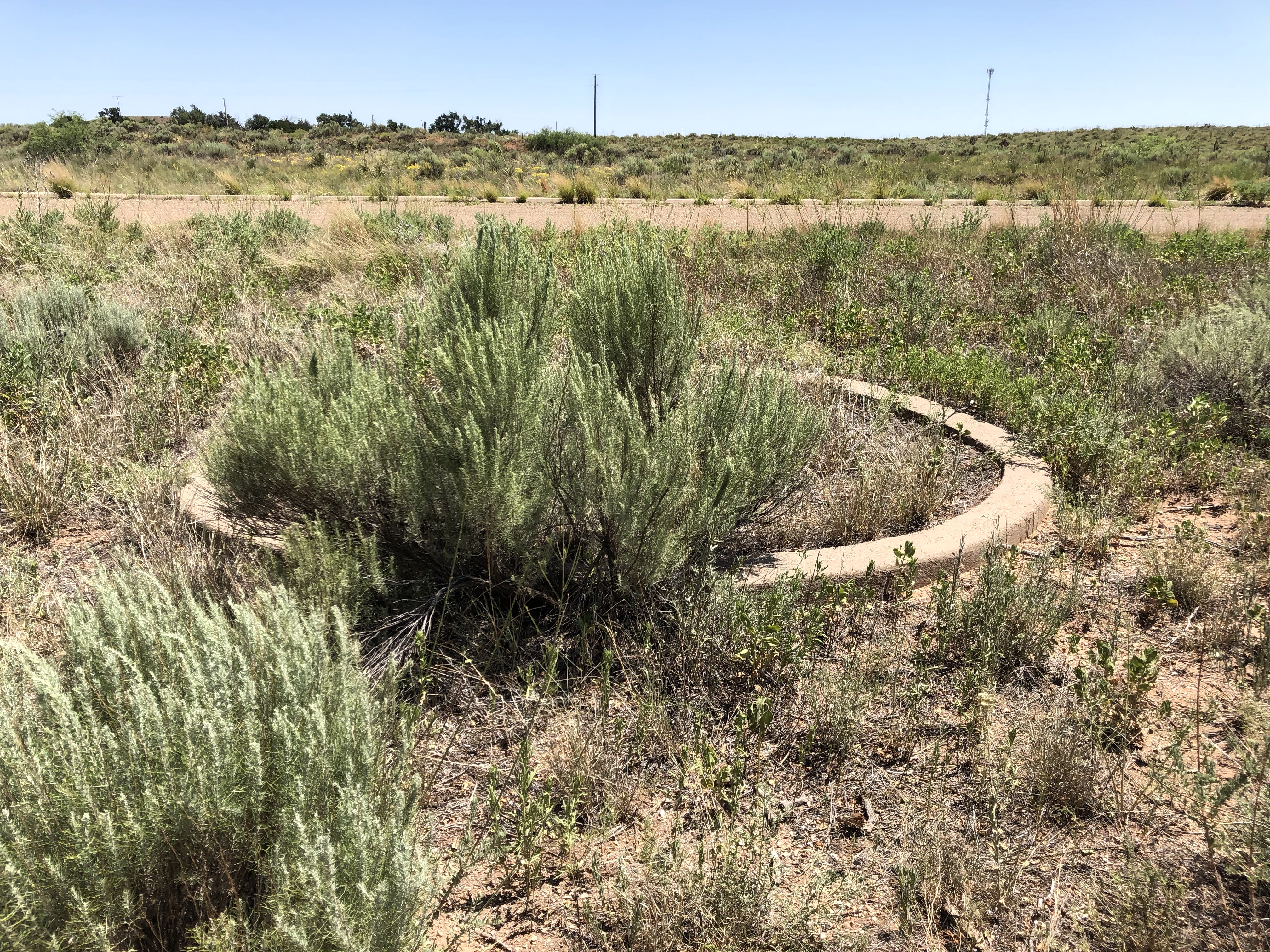
The original circle driveway concrete planter at the post office is still visible.
Texas Route 66 Roadbed
One sight that many visitors to Glenrio may not even realize they are looking at is a section of the original Route 66 roadbed that runs through town.
The first road through Glenrio was a dirt track which was gradually improved in the 1920s as part of the Ozark Trails highway. In 1926, the section of road was officially designated as U.S. 66, with a two-lane paved road completed through Glenrio by the late 1920s. Due to the popularity of the town and amount of traffic on the road, Route 66 was widened to four-lanes with a concrete median added on the New Mexico side. This asphalt-surfaced, four- lane highway remains drivable, but eventually runs into dirt road where the state pulled up the asphalt to avoid maintenance.
Grass now grows through the cracks in the asphalt on the four lanes but its worth the short drive just to say you’ve traveled part of the original Route.
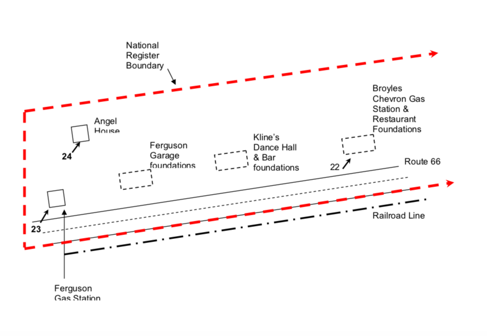
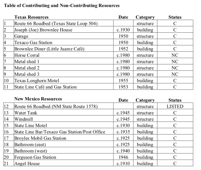
A handful of other foundations exist, but I won’t mention them here since the buildings they supported are gone. If you explore the town in person or just via Google maps, this key to the buildings and foundations will help to act as a good guide.
Courtesy of Texas Historical CommissionCourtesy of Texas Historical CommissionCourtesy of the Texas Historical Commission
Courtesy of Texas Historical Commission
You can drive through Glenrio in less than one minute without even going the speed limit, since the drive is just over a mile in length, but there is so much history there for those willing to stop.
After a bit of exploring, it was time to hop back in the car (and air conditioning), drink some cold water and to head to our next stop which I’ll share soon!
Not every good trip takes a lot of planning, but it really pays off when you’re going on a “theme” trip with family members!
This summer’s goal was to drive the section of Route 66 that goes through the Texas Panhandle, and I definitely did weeks of research through travel bureaus, internet, books and maps. I enjoyed the process and it really built up the anticipation for me!
After doing a preliminary review of the sites along the way, I decided to spread the drive across six days. Now, If you’re familiar at all with this section of Route 66 or the Panhandle, you’re probably thinking I may have lost my marbles since this stretch of road is just under 200 miles long and would only take about three hours to drive straight through!
But stay with me, here! There was so much to see!
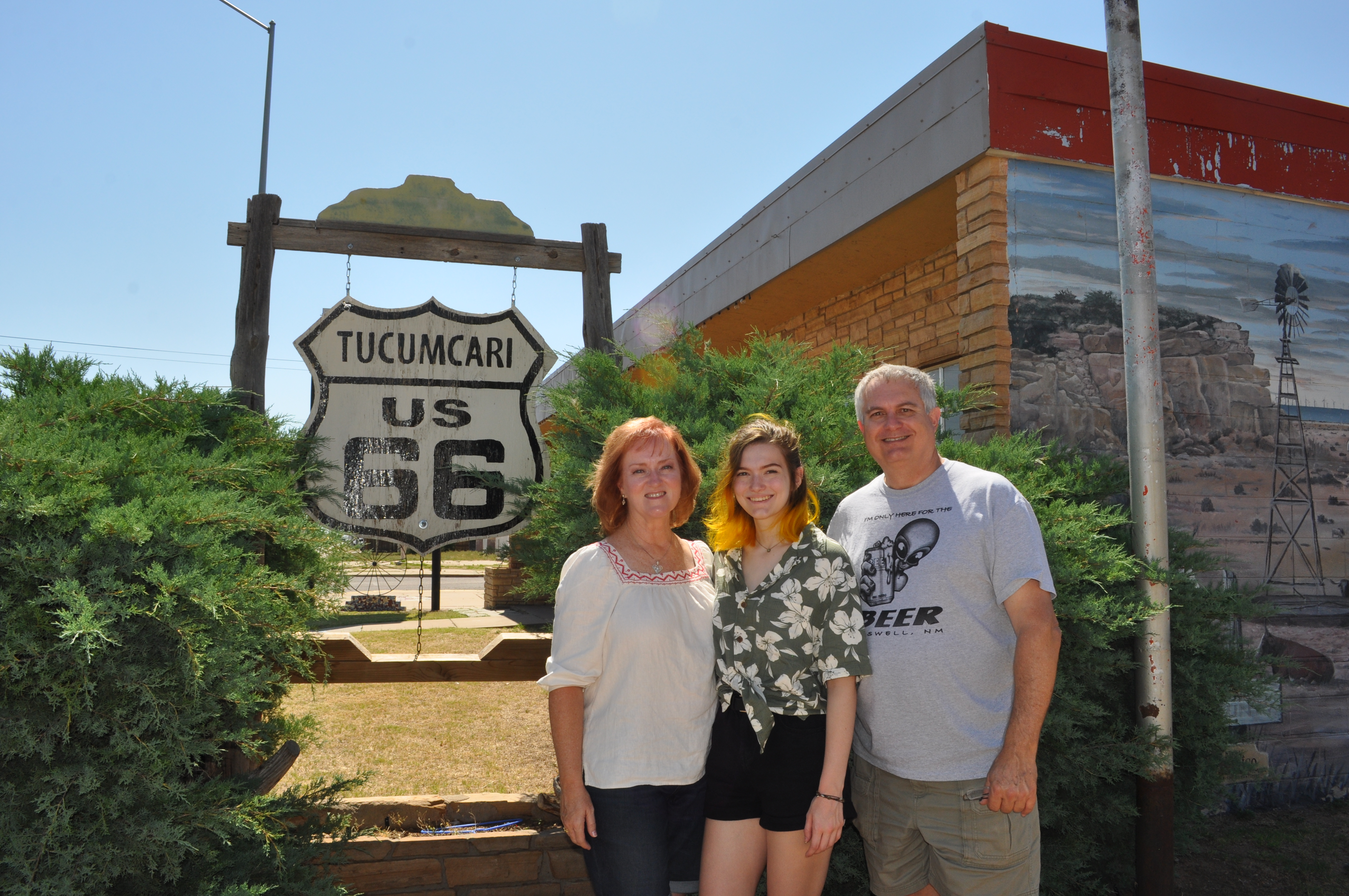
I decided to actually begin the drive in Tucumcari, New Mexico which is only about an hour west of the Texas border. I fell in love with photos of the old, restored motels from Route 66 that are still operating here while I was doing my research. It also helped to make sure we were going to include every inch of the Texas section of the road, which I was determined to do!
Blue Swallow Motel, Tucumcari, NM
The route would take us across the Panhandle to Texola, Oklahoma (although we took it all the way to Oklahoma City so we could cut south and spend a few days with friends on their ranch).
One of the challenges of planning the trip was to incorporate things that would be of special interest to everyone in my family.
My 17-year-old daughter is interested in music, animals, and antique and thrift shops. First things, first…she was in charge of the playlists for the road trip, and I’m so glad she was! She enjoys “vintage” music (like, um, from when I was in high school) as well as some of the new and alternative bands. My husband and I got to enjoy old favorites and hear some terrific new music and only once (yes, once!) asked her to skip to the next song.
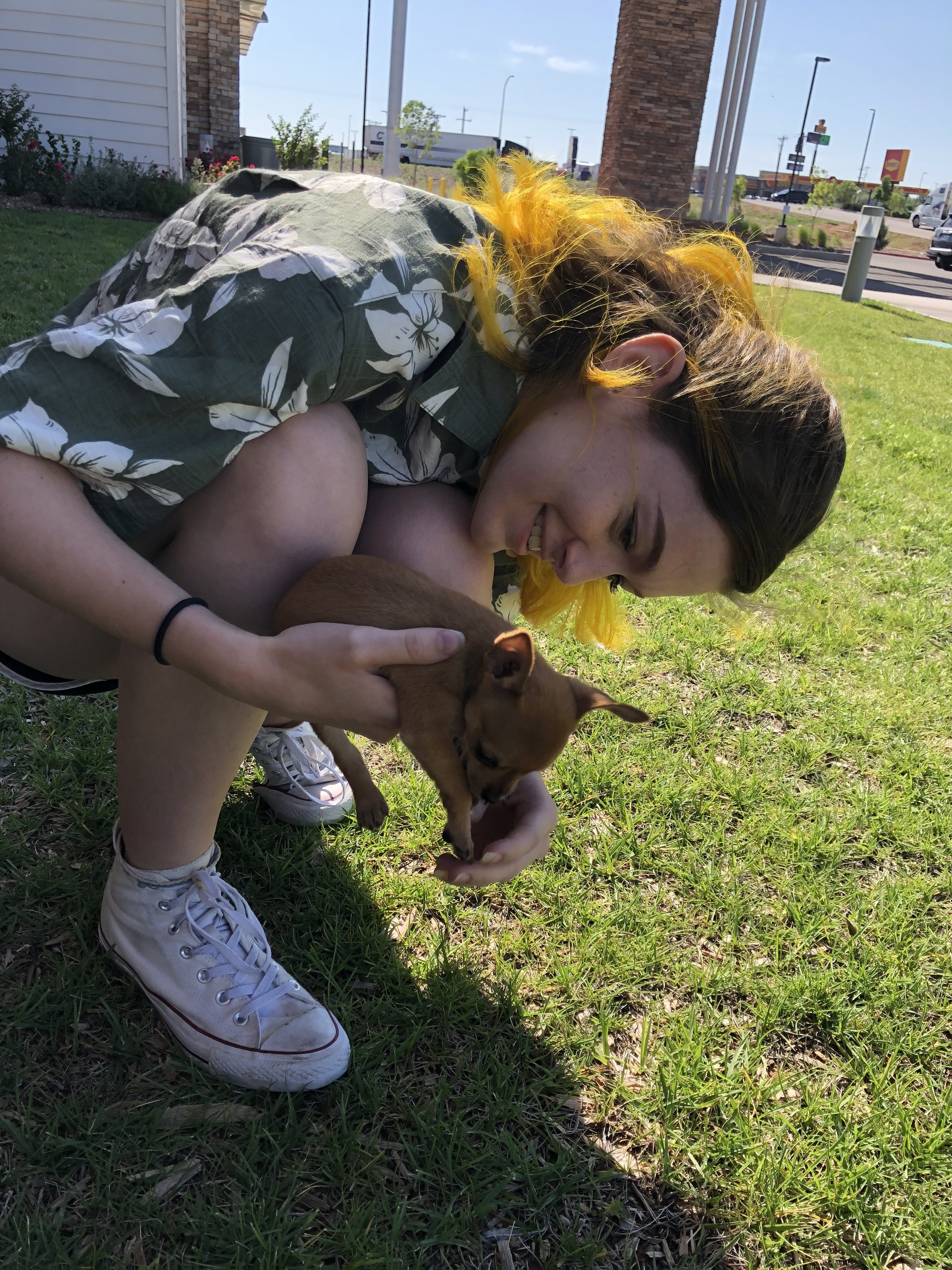
Fell in “puppy love” with this 7-week old chihuahua!
We came across plenty of animals on the trip, which was a treat, but incorporated riding horses into our “definitely do this” list. Seeing the land from horseback always seems to make exploring the outdoors more special.
There were countless antique and resale shops along the way, so I dove in and checked out online photos and reviews to find some that might suit her particular interests.
Special bonus: she recently got her driver’s license so she helped with the driving, too!
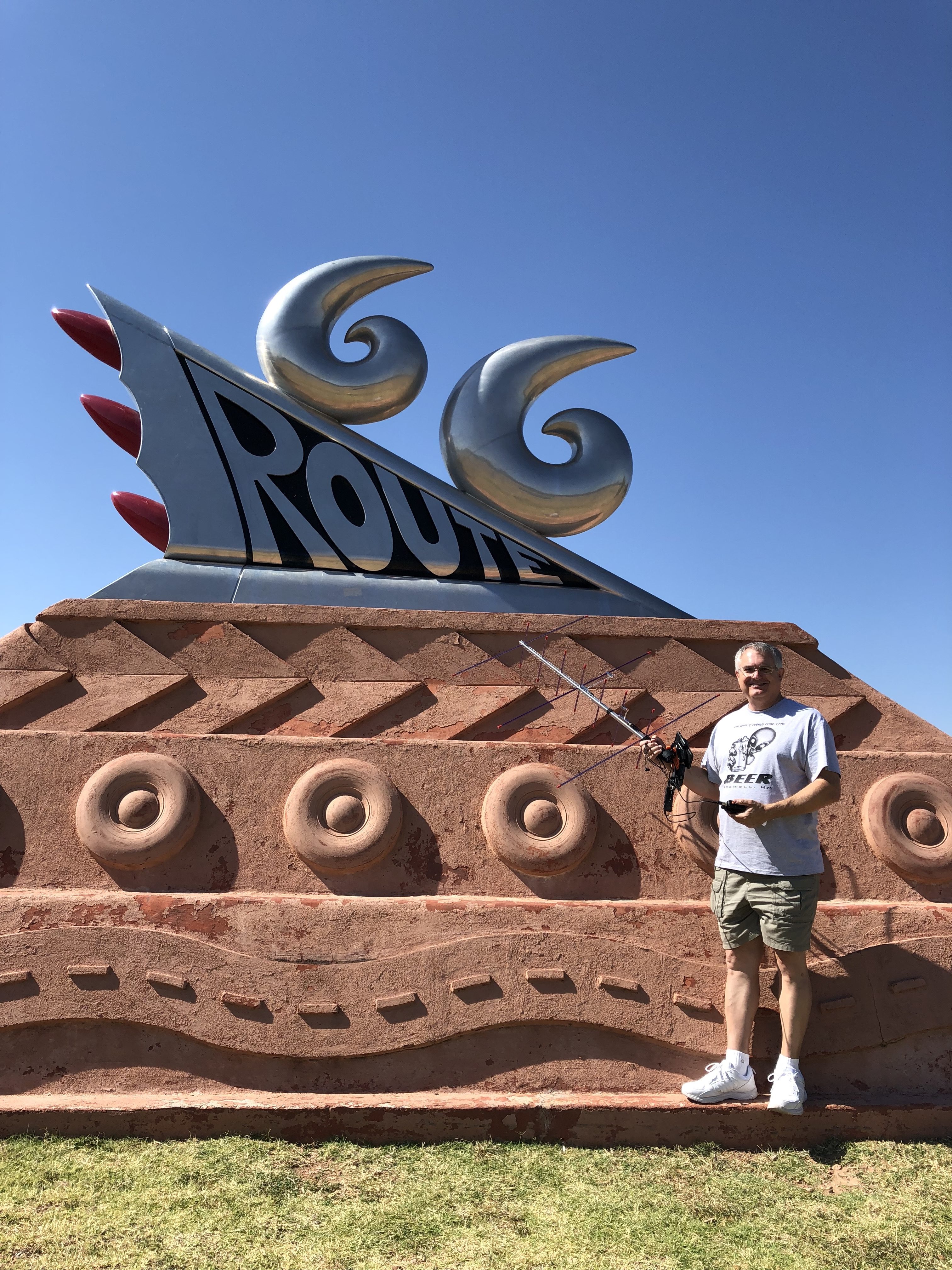
My husband is a ham radio operator (AB5SS, if any of you are, too!). He has a “roving” antennae and is operating to contact every “grid” in the United States. He decided to use this opportunity to help other “hams” contact grids along Route 66 that are difficult or impossible
to cross off their wishlists…and he sure made some people happy! He has a map of where each grid is along the way, so we made a point to stop (at least once) in each grid to give him a chance to operate. He announced via his twitter account that he would be doing this so that interested hams could mark it on their calendar, and then announced prior to each broadcast where they could find him on the air. He made over 150 contacts during the trip! That’s a lot of happy ham operators.
AB5SS
And of course I got some fun shots of him operating in unusual locations.
Besides Texas history and travel, I love old buildings, cemeteries and photography, so let’s admit it … I was basically set for this trip! (Insert “happy dance” here!)
Using Google Maps street view, I virtually “drove” any sections of the towns I was particularly interested in or not sure about. Familiarizing myself with how these places actually appear made things so much easier when we actually arrived, and circumvented some areas to cross off the list as being not as worthwhile.
Looking for a roadside attraction that’s “on point?” (Sorry, I couldn’t resist)
In line with making sure that everything really IS bigger in Texas, the town of Bowie offers a Guinness World Record Bowie knife.
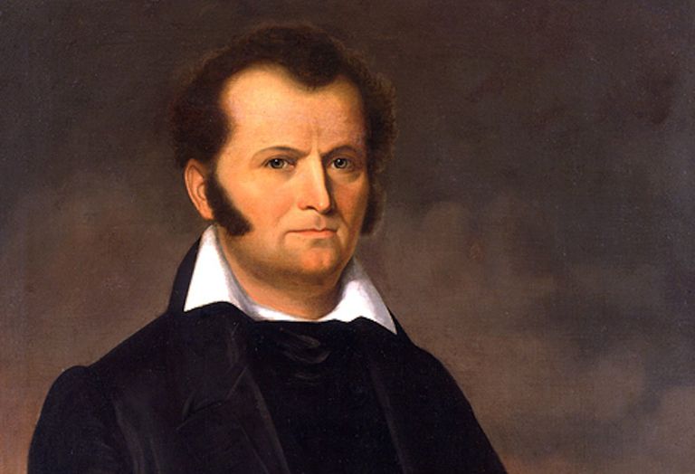
Now in case you aren’t familiar with Bowie or just need a quick refresher, Colonel James Bowie was one of the heroes of the Battle of the Alamo. But what his name will forever be linked to was a custom knife, designed for him by his brother Rezin. It was reportedly 9.5″ long, 1 1/4″ thick and 1 1/2″ wide with a simple riveted wood handle. It was his skill using this weapon that became legendary.
Colonel James Bowie
In an 1827 brawl with several men on a sandbar outside of Natchez, Mississippi, Bowie was stabbed in the chest, shot multiple times and beaten half to death but still managed to win the fight using his large knife. Two of his attackers lay dead and two grievously wounded. The action would be almost unbelievable if we watched it in a modern movie.
But back to the impressive roadside attraction that bears his name…
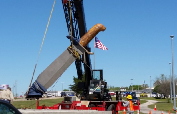
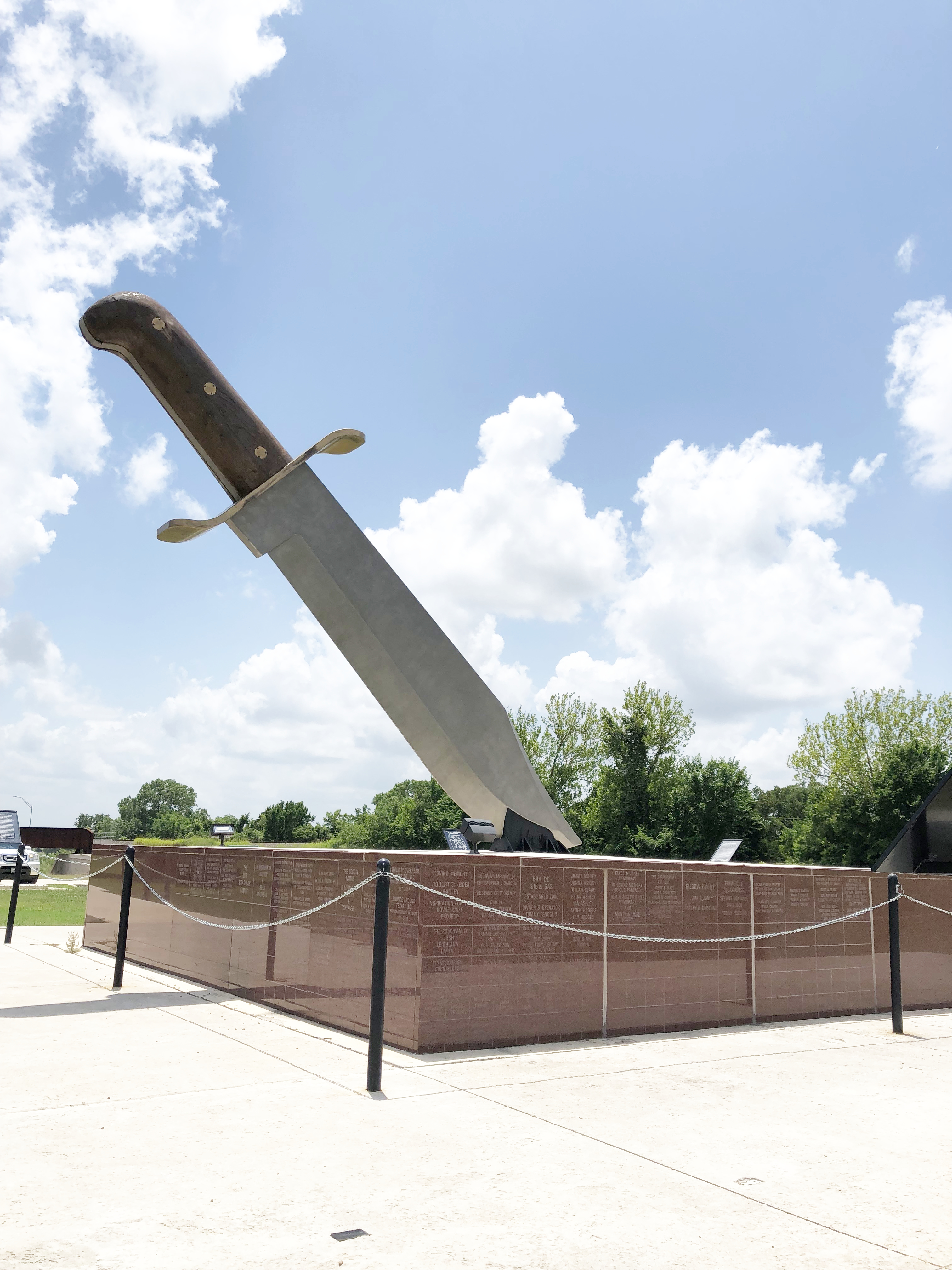
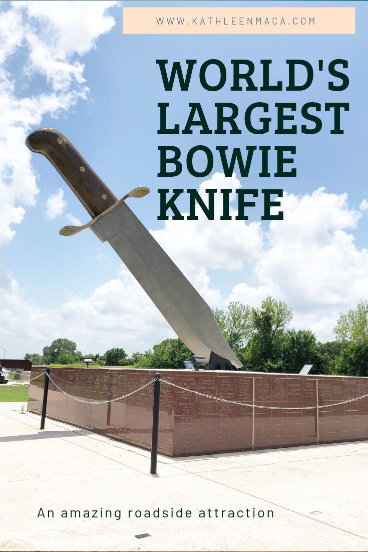
Bowie, Texas, Jim Bowie’s namesake town in Montague County, erected the world’s largest Bowie knife in his honor. The impressive weapon is 20’6″ in length and 16’10” high. The steel blade alone (which was created hollow to lessen the weight) is over 14′ long! Constructed basically the same as more functional versions of the knife, it is made of steel and brass with a wood handle made from a Bodark tree (*more information about this side fact below!). It weighs 3,000 pounds and had to be lifted into place with a crane. The monument was designed by engineers to withstand normal seismic activity, winds up to 90 per hour and an inch thick layer of ice. Basically, to be as tough as the man for whom it was named.
The blade isn’t sharpened for safety reasons, although crawling on the monument isn’t allowed. But the positioning of the knife provides some interesting photobombing opportunities.
You can see this cutting edge monument (sorry…again) for yourself in Pelham Park in Bowie, Texas. There is easy, free parking at the site as well as a few brief explanatory plaques about the man and his weapon.
This is one of those sights that will convince you everything really IS bigger in Texas.
*The Bodark tree that was used to create the handle of the monument goes by other names you might recognize: bois d’arc, Osage orange, horse apple, and hedge apple. The hardness of bois d’arc made it popular with wheelwrights for use in the spokes and hubs of wagon wheels, bridge timbers, foundation piers for houses and paving blocks. It was also prized for being the the perfect post material for barbed wire fences due to its toughness. I’d say that makes it an appropriate wood to incorporate into a Bowie Monument, wouldn’t you?
SITE: Roadside monument
LOCATION: Pelham Park, on the northbound side of US 81/E. Wise Street

 , he used his profits to buy the original small structure and began looking for a way to turn it into one of Route 66’s unique attractions.


